




Introduction
A professional land surveyor plays a critical role in various industries by accurately measuring and mapping land boundaries.
Land surveying supports urban planning, construction projects, property development, and environmental conservation.
Key responsibilities include conducting field surveys, analyzing data, and preparing reports.
Additionally, surveyors provide expert advice on property boundaries and land use.
Daily Routine
A professional land surveyor typically starts the day early.
First, they review project plans and identify the tools required for the day.
After gathering equipment, they travel to the field and conduct surveys.
There, the surveyor measures and marks boundaries, topographical features, and other important points.
Throughout the day, they record notes, sketches, and GPS coordinates accurately.
Meanwhile, they communicate with team members and clients to meet survey requirements.
Planning and Organizing Survey Work
Land surveyors carefully plan each day to improve productivity and efficiency.
They prioritize tasks according to deadlines and project requirements.
Before entering the field, surveyors confirm the necessary permits and site access permissions.
They also coordinate with engineers and architects to align survey data with project plans.
Consequently, strong time management helps surveyors meet deadlines and deliver accurate results.
Importance of Time Management
Professional land surveyors recognize how time affects project success.
They allocate time thoughtfully for each task to prevent delays and setbacks.
Effective time management allows them to handle multiple projects without reducing quality.
By staying organized and focused, surveyors meet tight deadlines and exceed client expectations.
Ultimately, time management skills support a successful career in land surveying.
Fieldwork Responsibilities and Demands
- Fieldwork tasks include:
Surveyors set up equipment, take measurements, mark boundaries, and collect data.
- Specialized equipment includes GPS and total stations:
GPS determines precise locations.
Meanwhile, total stations measure angles and distances.
- Outdoor conditions create physical demands:
Surveyors work through extreme temperatures, rain, snow, and rough terrain.
- Physical tasks include walking, carrying equipment, bending, and kneeling:
They walk long distances and carry heavy equipment during fieldwork.
Additionally, surveyors bend or kneel when taking measurements.
- Environmental challenges require careful navigation:
Surveyors navigate dense vegetation, bodies of water, and challenging terrain.
- Fieldwork safety remains essential:
Surveyors stay aware of their surroundings and wear appropriate safety gear.
They also follow established safety protocols throughout each assignment.
- Changing weather requires preparation:
Surveyors prepare for sudden storms, extreme heat, and other weather changes.
- Long hours require sustained focus:
Surveyors may work overtime to meet project deadlines.
They maintain concentration to preserve measurement accuracy during extended fieldwork.
Learn More: Best Practices for Efficient Warehouse Operations
Data Collection
Accurate data collection forms a central part of professional land surveying.
Surveyors gather measurements that support legal, construction, and mapping requirements.
They combine careful planning, dependable instruments, and specialized software to produce reliable survey results.
Process of Collecting Accurate Measurements and Data
Before collecting measurements, a surveyor plans the survey area and identifies the required equipment.
The surveyor then establishes equipment at designated points and follows the approved survey plan.
Afterward, specialized software processes the collected information for maps and reports.
- Surveyors use total stations, GPS receivers, and drones to measure distances and angles.
- Collected information can include boundary lines, topographic features, and elevations.
- The survey plan guides the systematic collection of information required for each project.
- Processed data helps surveyors create detailed maps and project reports.
Precision and Attention to Detail
Precise measurements help surveyors deliver accurate and dependable results.
Transform Your Career Today
Unlock a personalized career strategy that drives real results. Get tailored advice and a roadmap designed just for you.
Start NowEven small measurement errors can create significant discrepancies in final survey documents.
Surveyors therefore review their work carefully and confirm that data points align correctly.
- Accurate results support legal decisions and construction activities.
- Detailed checks help identify inconsistencies before surveyors finalize their work.
- Surveyors compare collected information with required project standards.
- Consistent precision strengthens professional integrity and client trust.
Technology That Streamlines Data Collection
Modern technology has improved the speed and efficiency of survey data collection.
Digital instruments allow surveyors to capture precise information while reducing fieldwork time.
Software also simplifies data processing and helps surveyors prepare detailed deliverables.
- GPS technology provides precise location data quickly and efficiently.
- Total stations and laser scanners capture accurate measurements with minimal error.
- Drones collect aerial images and topographic information for survey projects.
- Specialized software automates processing tasks and supports efficient report creation.
Learn More: Common Challenges Faced by Janitors and Custodians
Boundary Surveys
Boundary surveys determine the exact boundaries of land parcels.
They require technical skill, precision, and knowledge of legal descriptions and maps.
Surveyors use this work to clarify land ownership lines.
The Process of Conducting Boundary Surveys
Surveyors begin by researching the property’s legal description.
This description identifies the parcel’s dimensions and boundary information.
Next, the surveyor visits the site and examines its physical features.
The surveyor locates fences, boundary stones, and other existing markers.
Using total stations and GPS devices, the surveyor measures distances and angles.
These measurements help the surveyor define the property boundaries accurately.
After collecting the necessary data, the surveyor prepares a detailed property map or plat.
The plat shows boundary lines, dimensions, buildings, driveways, and other improvements.
This document provides an official record of the property’s boundaries.
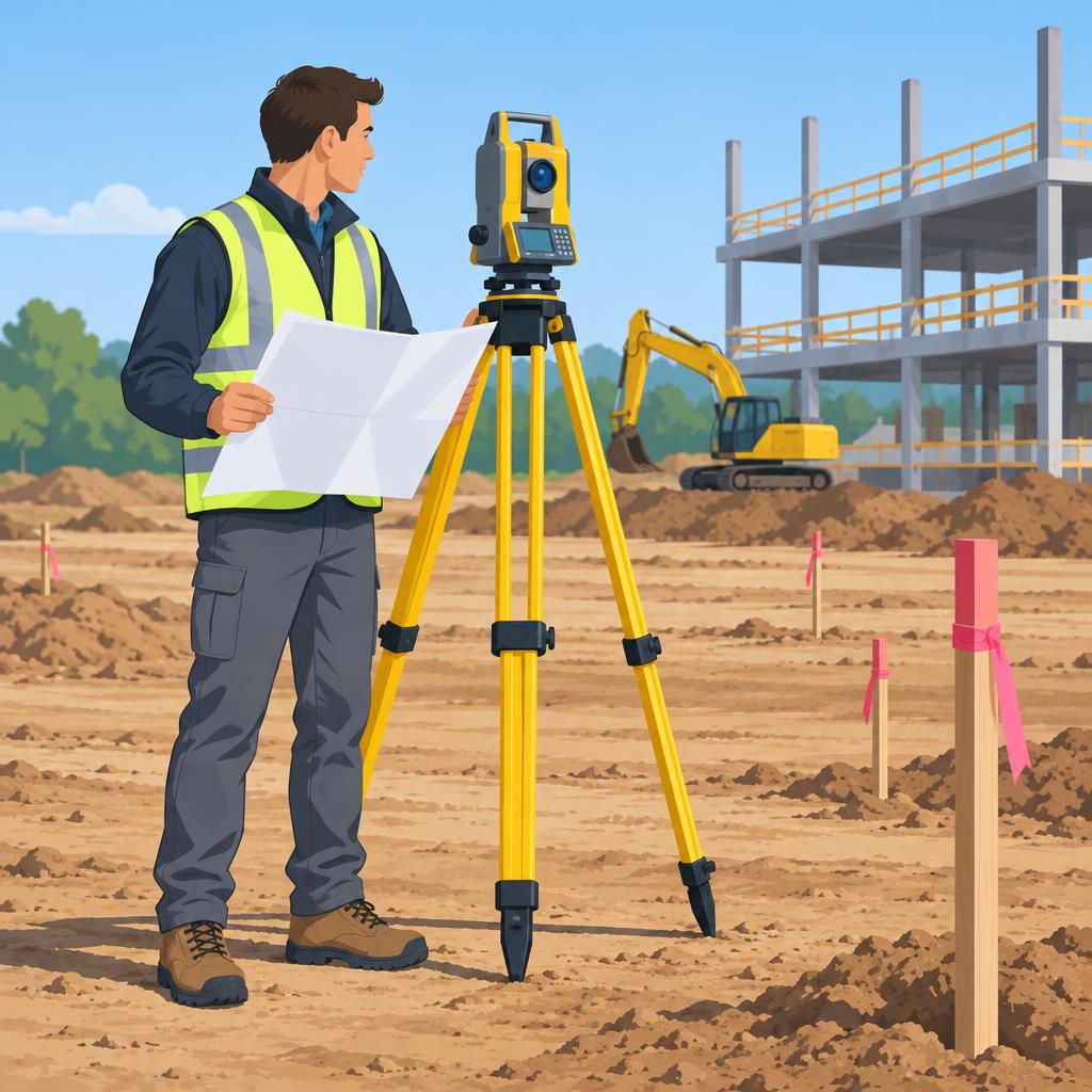
Using Legal Descriptions and Maps
Legal descriptions define boundaries through measurements, landmarks, and directions.
Property deeds and land records typically contain these descriptions.
Surveyors use legal descriptions as the foundation for locating property lines.
Maps visually represent the boundaries and physical features of a property.
Surveyors compare written descriptions with physical features shown on maps.
This comparison helps surveyors determine the exact location of property lines.
Surveyors may use aerial photography, GIS software, and traditional surveying methods.
These techniques help create accurate representations of property boundaries.
Boundary Surveying Challenges and Legal Implications
Boundary surveying can become complex when property records contain disputes or inconsistencies.
Surveyors must address encroachments, easements, and conflicting property descriptions.
Neighboring property owners may dispute the locations of shared boundaries.
A surveyor’s boundary determination can create significant financial and legal consequences.
Therefore, surveyors must maintain accuracy and precision throughout the process.
Boundary surveying laws and regulations vary by jurisdiction.
Surveyors must understand local zoning ordinances, property laws, and surveying standards.
Standards Supporting Reliable Property Boundaries
Professional surveyors combine legal research, field measurements, and mapping techniques.
This coordinated approach produces accurate and reliable property boundary information.
Accurate boundary surveys help landowners understand and document their property lines.
Discover More: Drywall Installation: Tips for Smooth Finishing
Office Work
Land surveyors perform important office tasks when they are not working in the field.
They analyze and process information collected during fieldwork.
They also communicate and collaborate with clients and colleagues.
Transform Your Career Today
Unlock a personalized career strategy that drives real results. Get tailored advice and a roadmap designed just for you.
Start NowOffice Tasks
Surveyors create and update maps, charts, and plans using field data.
They use specialized software to process and analyze survey information.
They prepare reports and documentation for clients and regulatory agencies.
- Creating and updating maps, charts, and plans based on field data.
- Using specialized software to process and analyze survey data.
- Preparing reports and documentation for clients and regulatory agencies.
- Calculating boundary lines and preparing legal descriptions.
These responsibilities require careful attention to detail and accuracy.
Accurate work helps survey results remain reliable and meet project requirements.
Surveyors must understand current technology and software to process field data effectively.
Communication With Clients and Colleagues
Communication and collaboration play important roles in a surveyor’s office work.
Surveyors work with clients, engineers, and other professionals to complete projects successfully.
They also ensure that projects meet the needs of all stakeholders.
- Surveyors communicate regularly with clients about requirements and expectations.
- They collaborate with colleagues to share information and coordinate project tasks.
- They clarify survey results and address client questions or concerns.
- They keep stakeholders informed about progress and potential issues.
Effective communication helps prevent misunderstandings and errors during projects.
It supports smoother workflows and more successful project outcomes.
It also strengthens relationships with clients and colleagues.
Collaboration Within Survey Teams
Survey teams often work together on large projects.
Team members share responsibilities and coordinate tasks throughout each project.
This cooperation helps teams complete work on time and within budget.
- Teams assign roles according to members’ strengths and expertise.
- Regular meetings address project progress, challenges, and solutions.
- Experienced surveyors train and mentor junior team members.
- Colleagues share best practices and lessons learned.
Effective teamwork allows surveyors to use their combined strengths and expertise.
As a result, teams can deliver accurate survey results that meet client requirements.
Collaboration also supports a positive workplace and a strong sense of teamwork.
Office work combines technical skills, communication abilities, and collaboration.
Surveyors who manage these responsibilities can complete projects accurately and efficiently.
These efforts support client satisfaction and successful project outcomes.
Discover More: Importance of Collaboration in Construction Projects
Continuing Education for Professional Land Surveyors
- Ongoing education and training help land surveyors stay current in a rapidly evolving field.
- Professional land surveyors must obtain industry certifications and licenses to practice legally.
- Staying current with technology and regulations helps surveyors perform their work effectively.
Continuing education remains vital for professional land surveyors.
Ongoing learning enhances their knowledge and skills while supporting continued professional growth.
Furthermore, education helps surveyors meet the requirements for licensed practice.
Professional land surveyors need industry certifications and licenses to work in the field.
These credentials show that individuals meet education and experience requirements established by licensing boards.
Surveyors must maintain these credentials to practice legally and ethically.
Advanced surveying equipment and software now support efficient data collection.
By learning new technologies, surveyors can improve productivity and provide accurate results for clients.
Additionally, surveyors must monitor current regulations and professional guidelines.
Land surveying operates within strict standards that protect the accuracy and integrity of professional work.
Awareness of regulatory changes helps surveyors avoid legal issues and satisfy necessary requirements.
Through continuing education, surveyors strengthen their skills and remain competitive in the field.
They also use current knowledge to provide high-quality services to their clients.
Problem-Solving in Land Surveying
Land surveying requires strong critical thinking and problem-solving skills.
Surveyors must respond quickly and logically to challenges during each project.
These skills help surveyors maintain accuracy and efficiency throughout their work.
The Role of Critical Thinking and Problem-Solving Skills
Surveyors analyze complex data to support accurate surveying decisions.
They also interpret legal documents and evaluate information carefully.
Transform Your Career Today
Unlock a personalized career strategy that drives real results. Get tailored advice and a roadmap designed just for you.
Start NowFurthermore, their decisions can affect the outcome of an entire project.
Common Challenges in Land Surveying
Land surveyors encounter several challenges while collecting and interpreting information.
These challenges may involve property boundaries, environmental conditions, equipment, or regulations.
Therefore, surveyors must evaluate each issue before selecting an appropriate response.
- Boundary disputes may involve conflicting property lines and disagreements between neighbors.
- Bodies of water and rocky terrain can make accurate surveying more difficult.
- Equipment failures or inaccurate GPS readings can create measurement errors.
- Regulatory changes may affect how surveyors complete their work.
Methods for Resolving Complex Surveying Issues
Surveyors apply their expertise to address difficult situations and protect survey accuracy.
They combine research, fieldwork, data analysis, and communication during the process.
As a result, they can correct discrepancies and deliver reliable surveying services.
- Surveyors research property boundaries, historical records, and local regulations.
- They conduct fieldwork with specialized tools and equipment to collect precise measurements.
- Surveyors analyze collected data to identify discrepancies and correct errors.
- They communicate with clients, colleagues, and stakeholders about project concerns.
- Surveyors develop practical solutions that preserve the accuracy and integrity of results.
A Professional Land Surveyor’s Daily Workflow
A professional land surveyor often begins the workday early.
First, the surveyor gathers the required equipment and travels to the assigned site.
After arriving, the surveyor positions the tools and begins measuring the land.
The surveyor uses GPS technology, total stations, and other sophisticated equipment.
These tools help the surveyor collect accurate information throughout the assignment.
Meanwhile, changing weather and difficult terrain can create demanding working conditions.
Remote locations may also require long hours and considerable physical endurance.
Surveying Expertise and Professional Contributions
Once fieldwork ends, the surveyor returns to the office to process the collected data.
Next, the surveyor analyzes the information and prepares maps, reports, and legal documents.
Careful attention to detail supports precise and reliable surveying results.
Additionally, surveyors collaborate with engineers, architects, and developers.
Their land information supports construction projects and land development.
Their dedication also helps preserve the integrity of essential land information.


