




Surveying is an essential profession that requires precision and accuracy when measuring lands and properties.
Top surveying tools and equipment help professional surveyors complete accurate work.
This section explores the tools and equipment surveyors use during their daily tasks.
Importance of Surveying Tools
These tools help surveyors collect data and make accurate measurements.
They also help surveyors analyze information and create detailed maps and reports.
Without these tools, surveying tasks would take longer and produce less reliable results.
Main Surveying Tools and Equipment
Professional surveyors use GPS receivers, total stations, levels, and drones.
These tools measure distances, elevations, and angles.
Additionally, drones capture aerial images for mapping and analysis.
Total Station
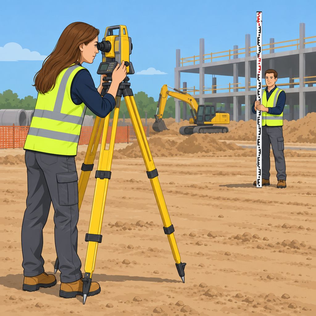
A total station combines an electronic theodolite with an electronic distance meter.
Surveyors use it to measure horizontal angles, vertical angles, and slope distances from one position.
The instrument also records measurements and supports real-time data processing.
Features and Functions
Total stations combine several electronic functions within one surveying instrument.
They measure angles, distances, and recorded data during surveying activities.
Additionally, remote control and auto tracking support efficient measurement tasks.
- Electronic theodolites measure horizontal and vertical angles with high precision.
- Electronic distance meters measure distances using infrared signals sent to prisms or targets.
- Data collectors record measurements and support real-time data processing.
- Remote control allows surveyors to operate total stations from a distance.
- Auto tracking follows reflective targets and supports accurate measurements.
Benefits of Using a Total Station
Total stations help surveyors complete several measurement and data collection tasks with one instrument.
Moreover, these instruments support accurate work across construction and topographic mapping applications.
Their data integration features also support seamless transfers and analysis with other equipment and software.
- Precision: Total stations provide accurate measurements for surveying projects.
- Efficiency: Surveyors measure angles, distances, and data with one instrument.
- Time-saving: Auto tracking helps surveyors complete projects quickly while maintaining accuracy.
- Data integration: Total stations communicate with surveying equipment and software for data transfer and analysis.
- Versatility: Total stations support construction and topographic mapping applications.
GPS/GNSS Receivers in Surveying
GPS/GNSS stands for Global Positioning System and Global Navigation Satellite System.
These satellite-based systems provide location and time information to receivers anywhere on Earth.
Surveyors use receivers to determine accurate positions, elevations, and distances for survey points.
- Definition: GPS/GNSS uses satellite signals to provide geolocation and time information.
- Surveying use: Surveyors establish control points, collect data, and create accurate maps with these receivers.
- Surveying tasks: Receivers calculate coordinates, elevations, and distances from signals received from multiple satellites.
- Advantages: GPS/GNSS receivers support accurate measurements, faster collection, higher productivity, and safer operations.
- Efficiency: Real-time positioning reduces errors and streamlines surveying workflows.
As a result, GPS/GNSS receivers improve accuracy, efficiency, and safety across many surveying projects.
Explore Further: Effective Problem-Solving in Construction Projects
Leveling Instruments
Leveling instruments help professional surveyors measure height differences and angles accurately.
These tools support reliable checks during surveying operations.
Different instrument types serve specific leveling purposes.
Spirit Levels
Spirit levels provide a simple method for checking horizontal alignment.
Each instrument contains a sealed glass tube filled with liquid and a bubble.
Surveyors use spirit levels to check equipment and structures.
Laser Levels
Laser levels project a level reference line using a laser beam.
They provide precise measurements across long distances.
Therefore, surveyors use them to set benchmarks, establish reference points, and measure elevations.
Uses of Leveling Instruments
Surveyors use leveling instruments to measure elevations and verify surface flatness.
They also align structures during surveying tasks.
Consequently, these tools help reduce errors and inconsistencies in survey data.
Benefits of Leveling Instruments
Accurate leveling supports dependable surveying decisions.
Moreover, efficient measurements help teams complete projects within planned workflows.
Careful checks also strengthen quality control and reduce risks from measurement errors.
- Ensure Accuracy: Leveling instruments help surveyors obtain precise measurements and reliable surveying data.
- Improve Efficiency: These instruments help surveyors complete their work more efficiently.
- Support Quality Control: Surveyors use them to verify the integrity of survey measurements.
- Reduce Costs: Accurate measurements help prevent costly errors and rework.
- Promote Safety: Reliable measurements reduce errors that could create safety hazards during surveying operations.
See Related Content: How to Make a Good First Impression as a New Mover
Measuring Wheels for Distance Measurement
Measuring wheels help professional surveyors determine distances across land.
Transform Your Career Today
Unlock a personalized career strategy that drives real results. Get tailored advice and a roadmap designed just for you.
Start NowEach tool uses a wheel and handle that rotate as the surveyor moves forward.
Meanwhile, an integrated counter records the distance covered during each measurement.
- Measuring wheels support accurate distance measurements.
- They help surveyors determine the lengths of land features.
- Surveyors commonly use them for linear measurements.
Measuring Wheel Applications in Surveying
Surveyors roll the wheel between two points to measure straight-line distances.
Additionally, the tool helps teams measure boundaries, roads, and utility line routes.
Construction teams can also use measuring wheels when checking plots and property lines.
- Surveyors measure distances between defined points.
- They assess road lengths during infrastructure planning.
- They measure routes for utility lines and related layouts.
Situations That Require Measuring Wheels
Surveyors can use measuring wheels when examining large agricultural fields or land plots.
They can also measure road distances for infrastructure planning and development.
Before fencing or construction begins, teams may verify property boundaries with these tools.
- Measuring large agricultural fields or land plots.
- Assessing road distances for development planning.
- Checking property boundaries before construction work.
Therefore, measuring wheels provide surveyors with an efficient method for recording ground distances.
Their practical design supports land surveys, infrastructure planning, and property boundary checks.
Uncover the Details: How to Handle Stress as a Warehouse Worker
Drones in Surveying and Mapping
Drones help surveying professionals collect data efficiently and accurately.
These aircraft carry high-resolution cameras and sensors for aerial data collection.
They also support mapping projects across construction, agriculture, and land development.
- Cost-effective mapping for large areas
- Reduced time for data collection and analysis
- Improved safety around hazardous or inaccessible areas
- Precise three-dimensional models and maps
Drones reduce the time required for data collection and analysis.
They also improve safety by keeping surveyors away from hazardous or inaccessible areas.
Furthermore, professionals can create precise three-dimensional models and maps from drone data.
Drones provide real-time data that helps teams make informed project decisions.
This information can improve efficiency and reduce project costs.
Drones have transformed surveying tasks by helping professionals work more effectively.
See Related Content: Health Risks and Mitigation for Boilermakers
Field Data Collectors
Field data collectors are electronic devices that surveyors use to gather and record information in the field.
They support surveying projects by organizing measurements and observations during fieldwork.
Additionally, digital records help surveyors prepare collected information for later analysis.
Modern Field Data Collector Features
Modern field data collectors combine durable hardware with practical tools for field operations.
They help surveyors enter measurements, capture images, and record notes during fieldwork.
Furthermore, compatible software and wireless connections support efficient data management.
- Rugged designs help field data collectors withstand demanding environmental conditions.
- Built-in GPS helps surveyors track locations during fieldwork.
- Touchscreen interfaces simplify data entry and device navigation.
- Wireless connectivity enables data transfers between compatible devices.
- Long-lasting batteries support uninterrupted data collection in the field.
- Surveying software compatibility supports data management and analysis.
Surveying Software for Professional Workflows
Surveying software supports modern surveying practices.
These tools help professionals collect, process, analyze, and manage survey data.
They also improve workflow efficiency and accuracy during surveying projects.
Trimble Business Center
Trimble Business Center provides comprehensive tools for processing, analyzing, and managing survey data.
The software supports various data formats for flexible project management.
Surveyors can create topographic maps, digital terrain models, and other survey deliverables.
Leica Geo Office
Leica Geo Office helps surveyors process and analyze survey data.
The software integrates with Leica Geosystems surveying instruments.
Surveyors can import and export data for additional analysis.
Carlson Survey
Carlson Survey provides tools for collecting, processing, and analyzing survey data.
Its user-friendly interface supports efficient surveying workflows.
The software can create points, generate contours, and calculate volumes.
Bentley MicroStation
Bentley MicroStation supports detailed drawings, maps, and models.
Transform Your Career Today
Unlock a personalized career strategy that drives real results. Get tailored advice and a roadmap designed just for you.
Start NowThe software provides tools for three-dimensional modeling and visualization.
It also supports geospatial analysis for complex surveying projects.
Autodesk Civil 3D
Autodesk Civil 3D combines civil engineering capabilities with surveying tools.
Surveyors can collect data, analyze information, and create accurate survey models.
The software also supports corridor design and construction documentation.
Topcon Magnet Office
Topcon Magnet Office processes and analyzes data collected with Topcon surveying instruments.
Its workflows help surveyors manage project information efficiently.
The software integrates with other Topcon software solutions.
Surveying Software Capabilities
Surveying software assists professionals throughout data collection, processing, and analysis.
These solutions allow surveyors to import data and create survey models.
They also support calculations, report generation, and final survey delivery.
Efficiency and Accuracy Improvements
Surveying software reduces manual errors during surveying tasks.
It also shortens processing time and increases professional productivity.
Furthermore, software helps surveyors deliver high-quality results to clients.
Visualization and Survey Analysis
Surveying software helps professionals visualize information in two-dimensional and three-dimensional formats.
These visualizations help surveyors identify trends and patterns within collected data.
Consequently, professionals can make informed decisions based on their analysis.
Software Support for Modern Surveying
Professional surveyors use software to strengthen their technical capabilities.
These solutions streamline data collection and processing across modern surveying projects.
As a result, surveyors can provide accurate and efficient survey deliverables.
Quality Surveying Tools Improve Field Performance
Professional surveyors rely on suitable instruments to collect accurate data and complete projects efficiently.
Total stations, GPS devices, and 3D laser scanners strengthen data collection and analysis across surveying projects.
These instruments help surveyors produce precise results for varied project requirements.
Surveyors should update their toolkits as technology continues to advance.
New equipment can improve productivity, accuracy, and performance during fieldwork.
Furthermore, ongoing technology updates help professionals respond to changing project demands.
Professional surveyors should invest in quality tools and equipment for dependable project work.
They should also monitor current surveying innovations and evaluate useful additions to their equipment.
With this approach, surveyors can address project needs and deliver precise, reliable results to clients.


