Introduction:
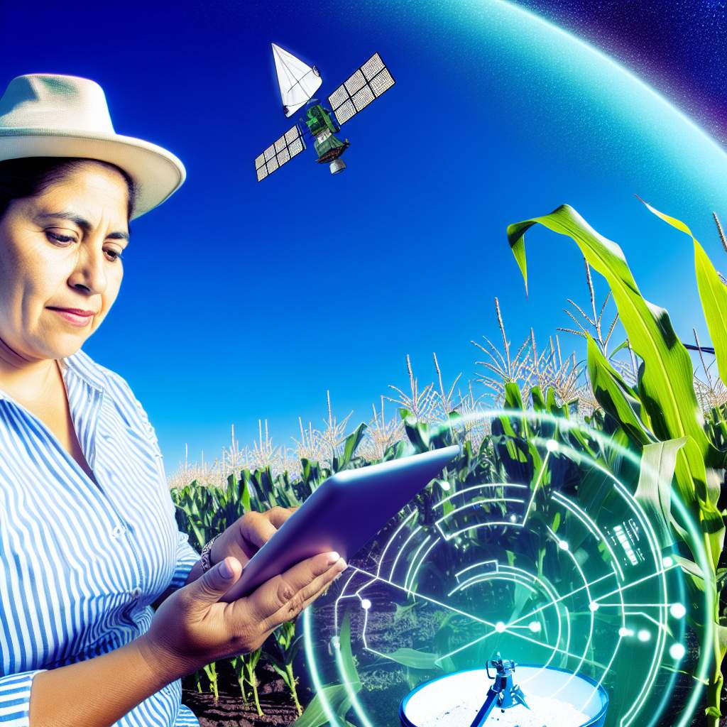
Precision agriculture is a modern farming technique that uses technology for increased efficiency and productivity.
Satellite imagery plays a crucial role in precision agriculture by providing detailed and accurate data.
Benefits of Using Satellite Imagery in Precision Agriculture:
Improved Crop Yield and Quality:
Satellite imagery in precision agriculture allows farmers to assess the health of their crops from above.
By analyzing the data collected, farmers can make informed decisions about how to care for their crops, leading to improved yield and quality.
Efficient Resource Management:
With satellite imagery, farmers can identify areas of their fields that may need more or less attention.
This helps in optimizing the use of resources such as water, fertilizer, and pesticides, resulting in cost savings and reduced environmental impact.
Early Detection of Plant Health Issues:
Satellite imagery can detect early signs of plant stress, disease, or nutrient deficiencies that may not be easily visible from the ground.
This early detection allows farmers to take proactive measures to address these issues before they spread and affect the entire crop.
How Satellite Imagery Works in Precision Agriculture:
Data Collection:
Satellites orbiting the Earth capture high-resolution images of agricultural fields.
These images can be taken at different wavelengths, allowing for the analysis of various factors such as vegetation health, soil moisture levels, and pest infestations.
Image Processing:
The raw satellite images are processed using specialized software to convert them into usable data.
This data is then analyzed to provide insights into the conditions of the crops, soil, and other relevant factors affecting agricultural production.
Data Analysis and Interpretation:
Once the data is processed, farmers can interpret the results to make decisions about their farming practices.
They can identify areas of the field that require attention, monitor crop growth over time, and track changes in soil health to ensure optimal conditions for plant growth.
Challenges and Limitations of Satellite Imagery in Precision Agriculture:
Cost:
Acquiring satellite imagery and accessing the necessary technology for analysis can be costly for small-scale farmers.
Additionally, the cost of implementing new farming practices based on satellite data may also be a barrier for some farmers.
Data Accuracy:
Satellite imagery may not always provide precise data, especially in cases of cloud cover or image distortion.
This can lead to inaccuracies in the analysis, potentially affecting the decisions made by farmers based on this data.
Technical Expertise:
Interpreting satellite imagery and using the data to inform agricultural practices requires a certain level of technical knowledge.
Farmers may need training to effectively utilize satellite data in their decision-making process.
Future Trends in the Use of Satellite Imagery in Precision Agriculture:
Integration with Other Technologies:
In the future, satellite imagery is likely to be integrated with other technologies such as drones and AI to provide more comprehensive data for farmers.
This convergence of technologies will enhance the accuracy and efficiency of farm management practices.
Increased Access and Affordability:
As technology advances and becomes more widespread, the cost of using satellite imagery in precision agriculture is expected to decrease.
This will make it more accessible to farmers of all scales, allowing them to benefit from the insights provided by satellite data.
Enhanced Data Analytics:
Improvements in data analytics capabilities will allow for more advanced analysis of satellite imagery.
Farmers will be able to receive real-time information about their crops, enabling them to make more timely and informed decisions to improve agricultural production.
Types of Satellite Imagery Used in Precision Agriculture:
Multispectral Imaging:
Multispectral images are captured at specific wavelengths.
Transform Your Career Today
Unlock a personalized career strategy that drives real results. Get tailored advice and a roadmap designed just for you.
Start NowThis allows farmers to monitor crop health.
They can detect diseases and assess plant stress levels.
Hyperspectral Imaging:
Hyperspectral imagery provides a more detailed view of crop health.
It identifies specific plant species and detects early signs of nutrient deficiencies or disease.
Synthetic Aperture Radar (SAR):
SAR technology uses radar signals to penetrate through clouds and darkness.
This makes it ideal for monitoring soil moisture levels.
It can also detect changes in crop structure.
In precision agriculture, each type of satellite imagery plays a crucial role.
They provide valuable information to farmers for making informed decisions about their crops.
By combining these different imaging technologies, farmers can gain a comprehensive understanding of their fields.
This helps to optimize their farming practices for increased yield and sustainability.
The use of satellite imagery in precision agriculture has revolutionized the way farmers approach crop management.
It leads to more efficient and environmentally-friendly farming practices.
Explore Further: Forest Management Techniques for Conservationists
How Satellite Imagery Is Collected and Processed
Satellites used for collecting imagery in precision agriculture orbit the Earth at various altitudes.
They capture images of the land below.
These satellites can be classified based on their altitude, such as low Earth orbit (LEO) or geostationary orbit.
Remote Sensing Technology
Remote sensing technology involves using sensors on satellites to detect and capture data about the Earth’s surface.
These sensors can detect various wavelengths of light.
This capability allows for the creation of different types of images, such as multispectral or hyperspectral.
Geographic Information Systems Integration
Once the satellite imagery is collected, it is processed and analyzed using Geographic Information Systems (GIS) software.
GIS allows for the integration of different data layers, such as soil type, crop health, and weather patterns.
This integration helps create detailed maps that aid farmers in making informed decisions.
Satellite imagery plays a crucial role in precision agriculture by providing farmers with valuable data about their fields.
By utilizing satellites, remote sensing technology, and GIS integration, farmers can optimize their crop management practices.
This optimization leads to improved overall efficiency.
Find Out More: Exploring Job Opportunities in Horticulture
Applications of Satellite Imagery in Precision Agriculture:
Soil Analysis and Mapping
Satellite imagery helps assess soil quality and map variations in nutrients for targeted applications.
It provides insights into soil moisture levels and soil composition for efficient farming practices.
By analyzing satellite images, farmers can identify areas that need specific treatments or adjustments.
Crop Monitoring and Management
Satellite imagery assists in monitoring crop health, growth stages, and detecting abnormalities early on.
Farmers can track vegetation indices, analyze plant density, and predict yields using satellite data.
This technology allows for precise management strategies, such as adjusting fertilizer application based on plant needs.
Irrigation Planning
Satellite imagery aids in optimizing water usage by monitoring soil moisture levels and crop water needs.
Farmers can plan irrigation schedules based on real-time data to prevent over- or under-watering.
By identifying dry spots or areas with excess moisture, farmers can implement targeted irrigation strategies.
Discover More: Extension Agents and Environmental Stewardship
Challenges and Limitations of Using Satellite Imagery in Precision Agriculture
When it comes to utilizing satellite imagery in precision agriculture, there are certainly a number of challenges and limitations that farmers and researchers need to be aware of.
Transform Your Career Today
Unlock a personalized career strategy that drives real results. Get tailored advice and a roadmap designed just for you.
Start NowThese challenges can impact the effectiveness and efficiency of implementing such technology in agricultural practices.
Let’s explore some of the key challenges:
Cost of Satellite Data
One of the major challenges faced by farmers and researchers is the cost associated with acquiring satellite data.
High-quality satellite imagery can be expensive, especially for small-scale farmers who may not have the financial resources to invest in such technology.
This cost barrier can prevent many from leveraging the benefits of satellite imagery in precision agriculture.
Limited Resolution for Detailed Analysis
Another limitation of using satellite imagery is the limited resolution it offers for detailed analysis.
While satellite images can provide valuable insights into crop health, soil moisture levels, and other factors, the resolution may not always be sufficient for identifying specific issues at a more granular level.
This limitation can hinder the precision and accuracy of decision-making in agricultural practices.
Weather Conditions Affecting Image Quality
Weather conditions play a significant role in affecting the quality of satellite imagery.
Cloud cover, atmospheric interference, and other environmental factors can impact the clarity and accuracy of satellite images.
In agricultural applications where real-time monitoring and analysis are crucial, unreliable image quality due to weather conditions can pose a challenge for farmers and researchers relying on satellite data.
By overcoming these hurdles through innovation, collaboration, and continuous improvements, we can maximize the potential of satellite imagery.
Ultimately, this can drive sustainable and efficient agricultural practices.
Find Out More: Famous Entomologists Who Changed Agricultural Practices
Integration of satellite imagery with other technologies in precision agriculture:
As technology continues to advance, precision agriculture has benefited greatly from the integration of satellite imagery with other cutting-edge technologies.
By combining satellite data with these tools, farmers can make more informed decisions, increase efficiency, and ultimately improve crop yields.
Drones for localized data collection
- Drones have revolutionized the way farmers collect data by providing high-resolution images of their fields.
- These unmanned aerial vehicles can capture detailed information on crop health, soil conditions, and pest infestations.
- By using drones, farmers can pinpoint specific areas that require attention, leading to targeted interventions and reduced costs.
- Additionally, drones can cover large areas quickly, allowing farmers to monitor their fields more frequently throughout the growing season.
Internet of Things (IoT) for real-time monitoring
- The Internet of Things (IoT) has enabled farmers to receive real-time data from various sensors placed in the field.
- These sensors can measure soil moisture levels, temperature, humidity, and other essential parameters that impact crop growth.
- By integrating satellite imagery with IoT technology, farmers can correlate environmental conditions with satellite data to make more accurate decisions.
- Furthermore, real-time monitoring allows farmers to respond promptly to changes in weather patterns or pest outbreaks.
Machine learning algorithms for data analysis
- Machine learning algorithms play a crucial role in analyzing the vast amounts of data collected from satellite imagery and other sources.
- These algorithms can identify patterns, predict crop yields, and recommend optimal planting schedules based on historical data.
- By leveraging machine learning, farmers can gain valuable insights into their fields and make data-driven decisions to maximize productivity.
- Moreover, machine learning algorithms can help farmers optimize resource use, such as water and fertilizer, ultimately reducing waste and environmental impact.
The integration of satellite imagery with drones, IoT, and machine learning algorithms has transformed precision agriculture.
By harnessing the power of these technologies, farmers can improve efficiency, optimize resources, and increase profitability.
As technology continues to evolve, the future of precision agriculture looks promising, with satellite imagery playing a central role in driving innovation and sustainable practices.
Recap of the Importance of Satellite Imagery in Precision Agriculture
Satellite imagery plays a crucial role in precision agriculture by providing farmers with valuable information on crop health, soil moisture levels, and pest infestations.
By analyzing these images, farmers can make informed decisions about irrigation, fertilizer application, and pest control, leading to increased yields and reduced costs.
Furthermore, satellite imagery allows for the early detection of potential problems, enabling farmers to take proactive measures to mitigate risks and optimize crop production.
Future Advancements and Potential Impact on Agricultural Practices
As technology continues to advance, we can expect further improvements in satellite imagery resolution, accuracy, and real-time monitoring capabilities.
These advancements will revolutionize agricultural practices by providing farmers with even more detailed and timely information to optimize their operations.
With the integration of artificial intelligence and machine learning algorithms, satellite imagery can help predict crop yields, identify disease outbreaks, and assess soil health with greater precision.
Satellite imagery is a powerful tool that is reshaping the future of agriculture, offering new possibilities for sustainable and efficient farming practices.
Additional Resources
Precision Agriculture: Benefits and Challenges for Technology …
Precision Agriculture in the Digital Era: Recent Adoption on U.S. Farms