Introduction
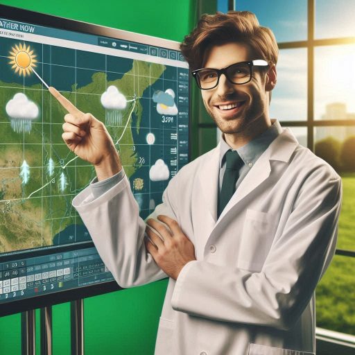
Tools and technology play a crucial role in the field of meteorology, significantly enhancing our ability to understand and predict weather patterns.
Meteorologists depend on a wide range of instruments and technologies to collect, analyze, and interpret atmospheric data effectively.
These resources not only improve forecasting accuracy but also ensure timely communication of critical weather information to the public.
In an era where severe weather events can have devastating impacts, reliable forecasting becomes vital for public safety and preparedness.
The importance of these tools cannot be overstated.
Instruments such as anemometers, barometers, and hygrometers allow meteorologists to measure wind speed, atmospheric pressure, and humidity, respectively.
These measurements form the foundation of weather analysis, enabling meteorologists to develop accurate forecasts.
Additionally, technologies like weather balloons and ground stations gather essential data from various altitudes, providing a comprehensive picture of the atmosphere.
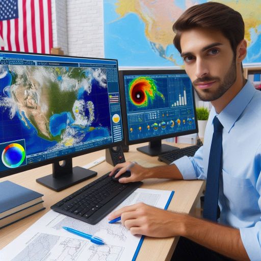
Recent advancements in technology have revolutionized weather forecasting over the past few decades.
The introduction of sophisticated radar systems has transformed how meteorologists track precipitation and storm development.
Doppler radar, for instance, provides real-time data on storm intensity and movement, allowing for timely warnings about severe weather.
Furthermore, satellite imagery offers a broad view of weather patterns across vast regions, helping meteorologists monitor cloud cover, temperature changes, and atmospheric disturbances.
Weather Balloons
How weather balloons are used to collect atmospheric data
Weather balloons play a vital role in gathering atmospheric data.
Meteorologists use these balloons to measure temperature, humidity, pressure, and wind speed at various altitudes.
Each weather balloon carries instruments called radiosondes.
These instruments collect and transmit data back to meteorologists in real-time.
The process begins with launching the balloon into the atmosphere.
As the balloon ascends, it expands due to decreasing air pressure.
This allows the instruments inside to gather critical data as they rise.
Meteorologists rely on this information to analyze weather conditions at different heights in the atmosphere.
The importance of this data in predicting weather patterns
The data collected by weather balloons is essential for predicting weather patterns.
It helps meteorologists understand how the atmosphere behaves at various levels.
This understanding is crucial for short-term weather forecasts and severe weather warnings.
For example, data from weather balloons can indicate the potential for thunderstorms or tornadoes.
Accurate predictions can save lives and property by allowing timely evacuations and preparations.
The improvements in weather balloon technology over the years
Over the years, weather balloon technology has seen significant improvements.
Earlier models used simple materials and basic instruments.
Today‘s weather balloons utilize advanced materials that can withstand extreme conditions.
These modern balloons can reach higher altitudes and carry more sophisticated instruments.
Some even include GPS technology, providing precise location data for meteorologists.
Furthermore, improvements in radio technology allow for better data transmission.
Weather balloons now transmit data more reliably and with greater accuracy.
This enhancement enables meteorologists to receive near real-time data, improving forecasting models.
In addition, advancements in automation have streamlined the balloon-launching process.
Automated weather stations can now launch balloons without human intervention.
This automation increases the frequency of data collection, providing more comprehensive weather insights.
Despite the advancements, weather balloons are still susceptible to certain limitations.
They can only operate in the lower atmosphere, typically up to 30 kilometers.
Beyond this altitude, other tools like satellites take over.
However, balloons remain crucial for initial atmospheric profiling.
Meteorologists also face challenges in weather balloon launches.
Weather conditions must be favorable to ensure successful data collection.
Strong winds or storms can disrupt launches, affecting data quality.
Nevertheless, the benefits of using weather balloons far outweigh the challenges.
Weather balloons are essential tools for meteorologists.
They collect crucial atmospheric data needed for accurate weather predictions.
With ongoing advancements in technology, these balloons continue to improve, enhancing meteorological research and safety.
The evolution of weather balloons reflects the ongoing commitment to understanding our atmosphere better.
Doppler Radar
How Doppler radar works to track precipitation and severe weather
Doppler radar is an essential tool for meteorologists, allowing them to track precipitation and severe weather.
This technology uses the Doppler effect to measure the velocity of rain, snow, and other precipitation.
A Doppler radar system emits radio waves into the atmosphere.
When these waves hit precipitation particles, they scatter and return to the radar dish.
By analyzing the frequency change of the returned waves, meteorologists can determine both the location and speed of precipitation.
The radar can distinguish between different types of precipitation, such as rain, sleet, or snow.
It also detects severe weather events, such as thunderstorms or tornadoes, by monitoring rapid changes in wind velocity.
This capability provides critical information for timely weather warnings.
The benefits of Doppler radar in forecasting storms with accuracy
Doppler radar significantly enhances the accuracy of storm forecasting.
It provides real-time data on precipitation intensity and movement.
This information allows meteorologists to track storm systems as they develop and move.
They can issue timely warnings for severe weather, helping communities prepare for potential hazards.
One of the key benefits of Doppler radar is its ability to identify rotation in thunderstorms.
This rotation can indicate the formation of tornadoes, enabling meteorologists to warn the public in advance.
Additionally, Doppler radar can detect areas of heavy rainfall, which can lead to flash flooding.
Accurate forecasts can save lives and minimize property damage.
Moreover, Doppler radar enhances the understanding of storm dynamics.
Meteorologists can study storm patterns and behaviors, improving future forecasts.
This capability supports better emergency planning and response efforts in communities.
The evolution of Doppler radar technology in meteorology
The evolution of Doppler radar technology has transformed meteorology.
The first Doppler radars were introduced in the 1970s, primarily for military use.
These early systems provided basic information about storm movement and intensity.
Over the years, advancements in technology have led to significant improvements in radar resolution and sensitivity.
Modern Doppler radar systems feature dual-polarization technology.
This technology sends and receives radar waves in both horizontal and vertical orientations.
It allows meteorologists to differentiate between various types of precipitation more accurately.
Dual-polarization also improves the ability to detect debris in severe storms, such as tornadoes.
Additionally, advances in data processing and visualization have enhanced Doppler radar’s effectiveness.
Meteorologists can now analyze and interpret data more quickly and accurately.
Real-time access to Doppler radar imagery allows for faster decision-making in emergency situations.
In recent years, the integration of Doppler radar with other technologies has further improved forecasting capabilities.
Combining radar data with satellite imagery and computer modeling provides a comprehensive view of weather systems.
This integration allows meteorologists to create more accurate and reliable forecasts.
Doppler radar is a key tool for meteorologists in tracking precipitation and severe weather.
Its ability to provide real-time data enhances forecasting accuracy and community safety.
The continuous evolution of Doppler radar technology has transformed meteorology, enabling better understanding and prediction of weather events.
This advancement reflects the commitment to improving public safety and preparedness in the face of severe weather.
Read: Exploring the Different Branches of Geology
Satellite Imaging
How satellite imaging helps meteorologists monitor weather systems globally
Satellite imaging plays a crucial role in helping meteorologists monitor weather systems on a global scale.
Satellites orbiting the Earth capture images of cloud patterns, temperature variations, and moisture levels.
This data provides meteorologists with a comprehensive view of weather systems across vast distances.
With satellite imagery, meteorologists can track weather patterns in real-time.
They observe the development of storms, fronts, and other atmospheric phenomena.
This capability is essential for understanding how weather systems interact and evolve.
By monitoring these systems from space, meteorologists can assess conditions that may lead to severe weather.
The role of satellite data in predicting tropical storms, hurricanes, and other severe weather events
Satellite data is invaluable in predicting tropical storms, hurricanes, and other severe weather events.
Satellites equipped with advanced sensors can detect changes in temperature and moisture levels over oceans.
These changes often signal the formation of tropical storms and hurricanes.
Meteorologists analyze satellite data to identify the potential strength and path of these storms.
They can monitor storm development, track movement, and predict landfall.
This information is vital for issuing timely warnings and preparing communities for potential impacts.
Moreover, satellite imagery helps meteorologists assess the structure and intensity of hurricanes.
They can observe eye formation and the distribution of rainfall.
This detailed information supports accurate forecasting, enabling better preparedness and response strategies.
Advancements in satellite technology that have improved forecasting capabilities
Advancements in satellite technology have significantly improved meteorological forecasting capabilities.
Modern satellites offer higher resolution images and more accurate data.
Newer satellites can monitor multiple wavelengths, allowing meteorologists to analyze various atmospheric properties.
For instance, geostationary satellites continuously observe the same area of the Earth.
This capability enables real-time monitoring of weather changes and rapid updates.
In contrast, polar-orbiting satellites provide global coverage, capturing data over a wider area.
Additionally, advancements in data processing have enhanced the usability of satellite information.
Meteorologists can access and analyze satellite data more quickly, leading to faster decision-making.
The integration of satellite data with computer models has also improved weather predictions.
Furthermore, new satellite missions focus on specific aspects of meteorology, such as precipitation and atmospheric composition.
These missions provide valuable insights into climate change and extreme weather events.
They contribute to a deeper understanding of the Earth‘s weather systems.
Satellite imaging is a vital resource for meteorologists worldwide.
It allows for comprehensive monitoring of weather systems, improving the accuracy of forecasts for severe weather events.
Advancements in satellite technology continue to enhance forecasting capabilities, supporting better preparedness and response in the face of changing weather patterns.
The ongoing evolution of satellite imaging reflects the commitment to understanding and mitigating the impacts of severe weather globally.
Read: Top Skills Needed for a Successful Geology Career
Computer Models
How computer models are essential in predicting weather patterns
Computer models are essential tools for predicting weather patterns.
These models use mathematical equations to simulate atmospheric processes and forecast weather conditions.
By analyzing data such as temperature, humidity, wind speed, and pressure, computer models generate predictions about future weather developments.
Meteorologists rely on these models to provide accurate short-term and long-term forecasts.
The ability to process vast amounts of data quickly allows computer models to identify trends and patterns that may not be easily visible through traditional observation methods.
This enhances the precision of weather predictions, helping people prepare for changing conditions.
How meteorologists use these models to simulate various scenarios
Meteorologists use computer models to simulate various weather scenarios, testing different outcomes based on changing atmospheric conditions.
They input real-time data from sources like weather stations, satellites, and Doppler radar into these models.
This data is then used to run simulations that predict how weather systems will evolve over time.
By running multiple simulations, meteorologists can explore a range of possibilities for storm tracks, temperature shifts, and precipitation patterns.
These models help assess the likelihood of specific weather events, such as heatwaves, cold fronts, or severe storms.
For example, during hurricane season, computer models can simulate multiple potential paths for a hurricane, helping forecast where it might make landfall.
Using various models allows meteorologists to compare results and determine the most probable outcomes.
This practice, known as ensemble forecasting, reduces uncertainty and increases the reliability of weather predictions.
These simulations give meteorologists valuable insights into how different factors interact to influence the weather.
The importance of updating and refining computer models for accurate weather predictions
Regularly updating and refining computer models is crucial for ensuring accurate weather predictions.
The atmosphere is highly dynamic, and weather conditions can change rapidly.
As new data becomes available, meteorologists continuously update the inputs used in their models to reflect current atmospheric conditions.
Refining the models themselves is also important.
Improvements in technology, data collection methods, and understanding of atmospheric physics lead to better model accuracy.
For instance, newer models may account for factors such as cloud formation, ocean currents, and the influence of topography on weather.
This results in more precise forecasts, especially for complex weather systems like thunderstorms and hurricanes.
Another critical aspect of model refinement is increasing the resolution of the simulations.
Higher resolution models provide more detailed predictions, allowing meteorologists to forecast localized weather events such as flash floods or microbursts more effectively.
Finally, validating computer models by comparing their forecasts with observed weather outcomes helps identify areas for improvement.
When models consistently produce accurate predictions, they build confidence in weather forecasts, leading to better decision-making for industries, governments, and the public.
Computer models are indispensable for meteorologists, providing essential tools for predicting weather patterns and simulating multiple scenarios.
Continuous updates and refinements ensure that these models deliver increasingly accurate weather forecasts, contributing to greater public safety and preparedness.
Read: The Future of Botany: Emerging Fields and Innovations
Weather Stations
The significance of weather stations in collecting real-time data
Weather stations are essential for collecting real-time weather data.
These ground-based stations continuously monitor local atmospheric conditions, providing meteorologists with valuable, immediate information.
Real-time data from weather stations includes temperature, humidity, wind speed, atmospheric pressure, and precipitation levels.
This data helps meteorologists assess local weather patterns and provides critical input for short-term forecasts.
Weather stations also contribute to early warning systems for severe weather events.
Data from multiple stations across regions allows meteorologists to detect sudden changes in weather conditions, such as approaching storms or shifts in temperature, enhancing public safety and preparedness.
The different instruments used in weather stations, such as thermometers and anemometers
Weather stations rely on several key instruments to monitor various atmospheric conditions.
A thermometer measures air temperature, one of the most fundamental aspects of weather observation.
Thermometers help determine the heat or cold levels in the atmosphere at a given time, contributing to temperature-based forecasts.
An anemometer is another important tool, measuring wind speed and direction.
This instrument is crucial for monitoring weather changes, especially in predicting storms and high-wind events.
Knowing wind speed helps meteorologists assess the intensity of weather systems like hurricanes or cold fronts.
Barometers measure atmospheric pressure, another vital piece of weather data.
Changes in air pressure can indicate shifts in weather, such as the approach of a low-pressure system associated with storms.
Hygrometers measure humidity, or the amount of moisture in the air, which helps predict precipitation and overall comfort levels.
Rain gauges track the amount of precipitation over a given period.
These instruments help meteorologists understand rainfall patterns, aiding in flood predictions and water resource management.
Some weather stations also include solar radiation sensors to measure sunlight levels, providing data relevant to agricultural planning and energy production.
How weather stations contribute to local weather forecasting
Weather stations play a critical role in local weather forecasting.
They provide accurate, real-time data from specific geographic locations, which is vital for short-term, localized forecasts.
This data allows meteorologists to observe minute-by-minute changes in atmospheric conditions, leading to highly accurate predictions of temperature, wind, and precipitation on a local scale.
For instance, data from weather stations can indicate the sudden onset of a storm in a particular area.
Localized data also helps forecast small-scale weather events like fog, frost, or heatwaves, enabling communities to prepare accordingly.
Additionally, by combining data from multiple weather stations, meteorologists can identify regional patterns that impact local forecasts.
Moreover, local weather stations help meteorologists provide tailored forecasts for specific industries, such as agriculture, transportation, or energy.
This level of precision supports better decision-making and risk management for businesses and governments.
Weather stations are invaluable for collecting real-time data, using various instruments to monitor atmospheric conditions.
This localized information enhances the accuracy of short-term weather predictions and contributes to community safety and preparedness.
Read: What Does a Geologist Do? Career Overview and Insights
Transform Your Career Today
Unlock a personalized career strategy that drives real results. Get tailored advice and a roadmap designed just for you.
Start NowUncover the Details: Top Universities for Meteorology Studies in the USA
Mobile Apps
The availability of weather apps for smartphones and tablets
Mobile apps have revolutionized how we access weather information.
Today, nearly everyone with a smartphone or tablet has access to weather apps.
These apps are available across platforms, including iOS and Android, making them accessible to a wide audience.
Whether it’s free or premium versions, there‘s a weather app designed to meet individual needs, offering features such as local forecasts, severe weather alerts, and real-time radar imagery.
How these apps provide real-time weather updates and forecasts
Weather apps provide real-time updates by tapping into meteorological data from weather stations, satellites, and Doppler radar.
These apps are continuously fed with the latest information, allowing users to access immediate weather changes.
Users can receive push notifications for severe weather alerts, ensuring they stay informed about dangerous conditions like thunderstorms or snowstorms.
In addition to current conditions, weather apps offer detailed forecasts, ranging from hourly updates to seven-day predictions.
These apps often incorporate interactive features such as radar maps, allowing users to track storms or monitor precipitation patterns directly on their devices.
The convenience of using mobile apps for everyday weather information
Weather apps offer unparalleled convenience for everyday use.
Instead of waiting for televised forecasts or searching online, users can instantly check the weather from anywhere with an internet connection.
With just a few taps, these apps provide local weather conditions, making it easy for users to plan their day, whether it‘s choosing the right clothes or deciding to bring an umbrella.
Moreover, the customization options allow users to set preferences such as location-based tracking, enabling automatic updates for their current location.
This feature is particularly useful for travelers, as it provides real-time weather updates on the go, without needing to manually input new locations.
In addition to their basic functionalities, many apps include specialized features, like pollen count for allergy sufferers or UV index alerts for those concerned about sun exposure.
Users can access weather data specific to their interests or activities, such as boating or hiking, making these apps versatile tools for various lifestyles.
Mobile weather apps offer users a convenient, on-the-go solution for accessing real-time weather updates and forecasts.
They simplify planning by delivering essential information instantly, wherever and whenever needed.
With advanced features, real-time updates, and personalized alerts, weather apps have become indispensable tools for everyday life, ensuring users are prepared for any weather condition.
Uncover the Details: Famous Archaeological Discoveries and Their Impact
Storm Chasing Equipment
The equipment used by storm chasers to track and monitor severe weather
Storm chasers rely on specialized equipment to track and monitor severe weather events such as tornadoes and thunderstorms.
One of the most crucial tools is a Doppler radar, which provides real-time data on storm intensity, wind speed, and movement.
In addition, storm chasers use GPS systems to navigate swiftly and safely toward active storm zones while avoiding dangerous areas.
Vehicles are often equipped with mounted anemometers, which measure wind speed, and barometers, which track atmospheric pressure changes.
Cameras, both video and still, are essential for capturing footage of storms in real time.
High-definition cameras allow chasers to document cloud formations, lightning, and funnel clouds with precision.
Drones are also becoming increasingly popular, offering a bird‘s-eye view of storms without putting chasers in danger.
In more advanced setups, storm chasers use mobile weather stations that can measure temperature, humidity, and precipitation levels in the field.
Some even deploy portable radar units or use weather balloons to gather atmospheric data at different altitudes, adding valuable information for storm analysis.
The risks and challenges of storm chasing
Storm chasing comes with inherent risks and challenges.
The most obvious danger is the proximity to violent weather systems, where high winds, debris, and lightning strikes are life-threatening hazards.
Tornadoes can change direction unpredictably, trapping storm chasers in vulnerable positions.
Flash floods and hailstorms add to the risks, making the terrain difficult to navigate or damaging equipment.
The fast-paced nature of storm chasing means split-second decision-making is essential to avoid injury or death.
Chasers often drive long distances at high speeds to catch up with storms, sometimes in rural areas with poor road conditions and limited communication.
Keeping the vehicle operational while managing the equipment presents another set of logistical challenges.
Additionally, chasing storms in unfamiliar areas can lead to issues such as road blockages, or getting lost in dangerous terrain.
How storm chasing has contributed to our understanding of extreme weather events
Despite the risks, storm chasing has significantly contributed to our understanding of extreme weather.
Storm chasers often gather data that meteorologists cannot obtain through traditional means.
By getting close to storms, they can collect valuable real-time data on wind speeds, pressure changes, and storm structure.
This data has helped improve tornado detection and storm prediction models, leading to better early warning systems.
Visual documentation from storm chasers also plays a critical role in understanding severe weather.
High-quality footage of storm development has given scientists insights into the formation of tornadoes and lightning strikes.
In particular, storm chasers have provided invaluable information for studying supercell thunderstorms, which often spawn tornadoes.
By risking their safety to gather data, storm chasers help meteorologists and researchers improve forecasting models.
This leads to more accurate predictions, reducing the loss of life and property during severe weather events.
Storm chasing continues to be a vital part of advancing weather science and mitigating the impacts of extreme weather.
Conclusion
Essential tools and technology play a critical role in meteorology, shaping how meteorologists analyze and predict weather patterns.
The effectiveness of weather forecasting hinges on these tools, which allow for accurate data collection and analysis.
Innovations such as radar, satellite imagery, and weather balloons provide real-time information about atmospheric conditions.
Advancements in technology have significantly improved forecasting accuracy over the years.
For example, Doppler radar helps meteorologists track storms in real time, while satellites provide comprehensive views of cloud formations and weather systems.
Predictive models, fueled by powerful computing capabilities, enable meteorologists to simulate various weather scenarios and anticipate future conditions.
These innovations help meteorologists make timely predictions and provide accurate warnings to the public.
The ability to forecast severe weather events, such as hurricanes and tornadoes, saves lives and minimizes property damage.
As technology continues to evolve, we can expect even greater precision in weather predictions.
Understanding these tools is essential for anyone interested in weather science.
Readers should explore additional resources on meteorological tools and technology to enhance their knowledge.
Engaging with these resources fosters a deeper appreciation for the science behind weather forecasting.
With the right tools, meteorologists can better serve communities by providing critical information about severe weather events.
Embracing these advancements ultimately leads to safer, more informed societies.
Investing time in learning about the latest technologies in meteorology will empower individuals to understand weather patterns and make informed decisions in their daily lives.