Introduction
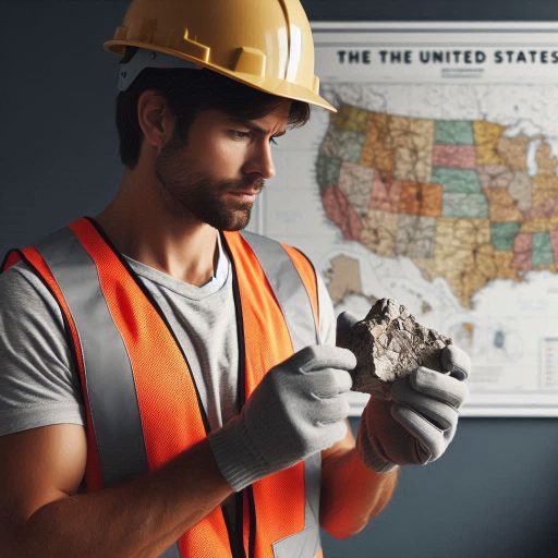
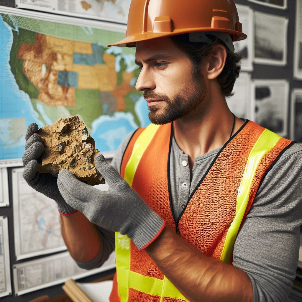
Geology refers to the study of the Earth’s materials, structures, and processes.
In urban planning, geology provides essential insights into the ground conditions where cities develop.
Understanding geological factors is crucial for creating safe and sustainable urban environments.
Geology plays a vital role in urban planning.
It helps planners assess soil stability, groundwater availability, and potential natural hazards.
For example, geologists identify areas prone to landslides, earthquakes, or flooding.
This information allows urban planners to make informed decisions about where to build infrastructure.
Additionally, geology influences the selection of construction materials and techniques.
By understanding local geology, planners can recommend suitable building methods and foundation designs.
This knowledge reduces risks and enhances the longevity of structures.
The purpose of this blog post is to highlight the importance of geology in urban planning.
We will explore how geological assessments contribute to effective land use and sustainable development.
By understanding geology‘s role, urban planners can address challenges related to population growth and environmental sustainability.
Join us as we delve deeper into the intersection of geology and urban planning, emphasizing the necessity of geological insights in building thriving communities!
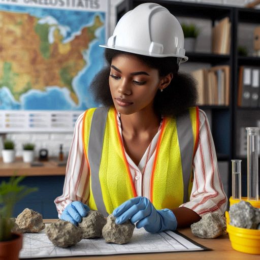
Understanding the geology of an area
The Importance of Studying Geological Features in Urban Planning
Studying the geological features of an area is crucial before initiating the urban planning process.
Understanding the geology provides insight into the land’s characteristics and behavior.
Each region has unique geological features, such as soil types, rock formations, and groundwater availability.
These elements significantly influence construction methods, land use, and environmental sustainability.
Geological studies reveal the presence of hazards like earthquakes, landslides, and flooding.
Identifying these risks early helps planners design safer, more resilient structures.
For example, areas with a history of seismic activity may require specialized building codes.
Understanding soil stability can prevent costly damages and ensure public safety.
Moreover, geological assessments help determine the suitability of land for specific uses.
Certain areas may be ideal for residential development, while others are better suited for commercial use.
Studying local geology allows planners to choose the best locations for schools, parks, and infrastructure.
This strategic planning enhances the quality of life for residents and reduces long-term costs.
Making Informed Decisions About Land Use and Development
Knowledge of the land’s geology helps urban planners make informed decisions about land use and development.
Geologists provide valuable data on soil composition, groundwater levels, and mineral resources.
This information guides planners in evaluating the feasibility of construction projects.
For instance, areas with loose, sandy soil may require additional foundation support for buildings.
Planners can decide whether to implement deep foundations or other stabilization techniques.
Conversely, stable bedrock may facilitate more straightforward construction methods.
Understanding these geological factors enables planners to devise effective strategies for development.
Furthermore, knowledge of groundwater resources is essential for sustainable urban planning.
Geologists can identify aquifers and assess their recharge rates.
This information helps planners ensure adequate water supply for residents and businesses.
Effective management of water resources is crucial for minimizing drought impacts and preserving ecosystems.
Understanding geological features also aids in environmental preservation.
Urban planners must consider how development impacts local ecosystems and natural resources.
Knowledge of sensitive areas, such as wetlands and floodplains, allows for better protection measures.
By minimizing disruption to these habitats, planners can promote biodiversity and maintain natural landscapes.
In addition, geological studies can uncover valuable mineral resources.
Urban planners may consider integrating mining operations into the development plan.
However, they must weigh economic benefits against environmental concerns.
Sustainable practices should guide resource extraction to ensure minimal ecological impact.
Studying geological features is vital before starting the urban planning process.
Understanding the land’s geology helps identify risks, inform development decisions, and promote sustainability.
Knowledge of soil stability, groundwater availability, and natural resources leads to smarter land use.
By incorporating geological insights into urban planning, communities can thrive in safe, sustainable environments.
Read: Challenges and Rewards: The Dual Life of an U.S. Environmental Scientist
Natural hazard assessment
The Role of Geology in Identifying Natural Hazards
Geology plays a vital role in identifying and assessing natural hazards.
Understanding the Earth’s materials and processes helps predict potential risks.
For instance, geologists study fault lines to evaluate earthquake risks.
They analyze historical data to identify areas prone to seismic activity.
Landslides are another significant hazard that geology helps assess.
By examining slope stability and soil composition, geologists can pinpoint vulnerable areas.
Their assessments consider rainfall patterns, vegetation, and human activities that might trigger landslides.
Floods also pose considerable risks to urban areas.
Geologists evaluate floodplains and watershed characteristics to understand flood potential.
They assess the likelihood of flooding based on geological formations and precipitation patterns.
This information is crucial for determining where to build infrastructure safely.
Additionally, geology informs the understanding of volcanic activity in some regions.
By studying past eruptions and the characteristics of volcanic materials, geologists can identify hazard zones.
This knowledge helps communities prepare for potential eruptions and establish evacuation plans.
Incorporating Geological Information into Urban Planning
Integrating geological information into urban planning significantly reduces risks.
Planners can use geological assessments to make informed decisions about land use.
They can identify safe locations for residential and commercial developments.
By avoiding hazardous areas, they help protect residents from natural disasters.
Incorporating geological data also aids in designing resilient infrastructure.
Engineers can create structures that withstand earthquakes, landslides, and floods.
For example, buildings in earthquake-prone areas can utilize flexible materials.
This adaptability enhances safety and minimizes damage during seismic events.
Urban planners can also implement effective drainage systems based on geological assessments.
Understanding soil types and drainage patterns helps mitigate flooding risks.
By designing infrastructure that manages stormwater effectively, cities can reduce flooding incidents.
Moreover, community education is essential for disaster preparedness.
Urban planners can inform residents about local hazards and safety measures.
Public awareness campaigns can encourage homeowners to assess their property‘s vulnerability to natural hazards.
Effective land-use policies also stem from geological studies.
Planners can develop zoning regulations that restrict building in high-risk areas.
These regulations help maintain safe distances from fault lines, flood zones, and unstable slopes.
Additionally, long-term urban development strategies benefit from geological insights.
By forecasting potential natural hazards, planners can devise strategies for future growth.
Sustainable development considers geological conditions to ensure the safety of new constructions.
The importance of geology in urban planning cannot be overstated.
Geologists help identify and assess natural hazards, providing essential data for urban planners.
Integrating this information into planning reduces risks and ensures safety for residents.
By understanding geological conditions, communities can design resilient infrastructure and establish effective disaster preparedness measures.
Incorporating geological insights leads to safer, more sustainable urban environments.
Read: Job Market Trends: Future of Chemistry Jobs in America
Resource management
The Role of Geology in Managing Natural Resources
Geology plays a vital role in managing natural resources.
It helps identify and assess the availability of essential resources like water, minerals, and energy.
Understanding the geological composition of an area guides urban planners in resource management.
Water resources are often influenced by geological formations.
Aquifers store groundwater, providing drinking water and irrigation.
Planners must consider the geology of an area to ensure sustainable water use.
Knowledge of rock types and soil characteristics helps determine where to locate wells and reservoirs.
Mineral resources also depend on geological factors.
Geologists map mineral deposits, identifying locations rich in resources like copper, gold, and coal.
Urban planners can then prioritize areas for sustainable extraction.
This approach minimizes environmental impact while ensuring resource availability for future generations.
Energy resources are another crucial aspect of geology.
Fossil fuels, such as oil and natural gas, require specific geological conditions for formation.
Planners assess geological formations to determine suitable sites for energy extraction.
Geothermal energy, which relies on heat from the Earth, also depends on geological characteristics.
Understanding geological formations ensures that planners make informed decisions about resource extraction.
Properly managing these resources contributes to the overall sustainability of urban environments.
Utilizing Geological Data for Sustainable Decisions
Urban planners can leverage geological data to make sustainable decisions.
They can use geological surveys and maps to understand the land’s composition.
This information guides zoning regulations and land-use planning.
Geological data helps planners assess the environmental impact of development projects.
By understanding soil stability and groundwater conditions, planners can minimize risks.
For example, they can avoid building on unstable ground, reducing the likelihood of landslides.
Additionally, geological data informs planners about potential natural hazards.
Areas prone to earthquakes, floods, or landslides require special attention.
Planners can implement safety measures and create zoning regulations to protect communities.
Sustainable resource extraction is another crucial consideration.
Planners can use geological assessments to identify suitable sites for mining or drilling.
This ensures that resource extraction aligns with environmental regulations and community needs.
Moreover, planners can develop strategies for rehabilitating land after resource extraction.
Understanding geological processes allows for effective reclamation of mined areas.
This ensures that ecosystems are restored and that land remains usable for future generations.
Collaboration between geologists and urban planners is essential.
Regular communication ensures that geological insights inform planning decisions.
This partnership leads to more resilient and sustainable urban environments.
In summary, geology significantly influences urban planning and natural resource management.
By understanding geological formations, planners can make informed decisions regarding water, minerals, and energy.
Utilizing geological data helps ensure sustainable extraction and minimizes environmental impact.
This approach supports the creation of thriving, resilient communities.
Read: Challenges and Rewards: Navigating the Chemist Career Path
Infrastructure development
The Role of Geology in Infrastructure Design
Understanding geology is crucial for designing and constructing infrastructure such as buildings, roads, and bridges.
Geologists assess the underlying geological conditions before any construction begins.
They analyze soil types, rock formations, and groundwater levels, which influence structural stability.
Knowledge of geology helps engineers select appropriate construction materials.
For instance, weak soils may require stronger foundations.
By understanding the geological context, engineers can design safer and more durable structures.
This knowledge also aids in determining the most suitable construction techniques.
Additionally, geology plays a significant role in identifying potential hazards.
Geologists evaluate the risk of landslides, earthquakes, and flooding in urban areas.
This information is vital for planning infrastructure projects that can withstand these natural disasters.
When building roads, geologists assess the terrain to ensure proper drainage.
Poor drainage can lead to erosion and road damage.
Understanding the geology helps engineers create efficient drainage systems that enhance road safety.
In bridge construction, geological studies inform decisions about foundation design.
Engineers must consider factors like soil strength and bedrock location.
A well-designed foundation minimizes the risk of structural failure and enhances the bridge‘s lifespan.
Ensuring Longevity and Stability of Urban Infrastructure
Considering geological factors is essential for the longevity and stability of infrastructure in urban areas.
Urban environments often face unique geological challenges due to dense population and development.
Rapid urbanization can strain natural resources and increase the risk of geological hazards.
Understanding the local geology allows urban planners to implement effective risk management strategies.
By considering geological factors, they can develop infrastructure that minimizes the impact of natural disasters.
For example, planners can avoid building in flood-prone areas or on unstable slopes.
Additionally, proper geological assessments can inform land-use planning.
This ensures that construction projects align with the natural landscape.
By respecting geological boundaries, urban planners can create more sustainable and resilient communities.
Geological knowledge also influences environmental impact assessments.
Before any project begins, geologists evaluate potential effects on the surrounding environment.
This helps ensure that infrastructure development does not disrupt local ecosystems or lead to soil erosion.
Furthermore, geology affects resource management in urban areas.
Urban planners must consider groundwater availability and quality.
Over-extraction of groundwater can lead to subsidence and infrastructure damage.
Understanding geological formations helps manage these resources sustainably.
Incorporating geology into urban planning fosters collaboration among various disciplines.
Engineers, geologists, and urban planners work together to create safe and sustainable infrastructure.
This interdisciplinary approach enhances the overall quality of urban development.
Ultimately, understanding geology is vital for effective urban planning.
It ensures that infrastructure projects are designed with safety and longevity in mind.
By considering geological factors, urban areas can thrive while minimizing risks associated with natural hazards.
This proactive approach leads to resilient communities prepared for future challenges.
Read: Diverse Career Paths: From Chemist to Patent Attorney in the US
Land use planning
Geology‘s Influence on Land Use and Zoning
Geological assessments shape land use decisions significantly.
Different types of land require distinct geological conditions.
For instance, residential areas need stable ground and reliable drainage.
Planners consider soil composition, rock types, and groundwater levels when designating land use.
Zoning regulations often reflect geological conditions.
Areas prone to landslides or flooding may be designated for non-residential use.
This approach protects public safety and preserves infrastructure.
Local governments often consult geologists when establishing zoning laws.
They rely on expert assessments to identify suitable zones for development.
Building regulations also depend heavily on geological factors.
Structures in areas with loose soil or high seismic activity need special considerations.
Engineers and architects must design buildings to withstand geological stresses.
This process includes using appropriate materials and construction techniques.
Regulatory bodies often enforce strict codes based on geological surveys.
These codes help ensure that buildings remain safe and functional over time.
Identifying Suitable Locations for Development Projects
Understanding geological processes aids in selecting ideal locations for development projects.
Geologists study various factors, including soil stability and groundwater availability.
They evaluate these elements to determine where construction can occur safely.
For example, regions with solid bedrock are often better suited for heavy structures.
Geological surveys help identify areas that may be prone to natural hazards.
Planners must consider the risk of earthquakes, floods, and landslides.
Understanding these risks allows urban planners to avoid high-risk areas.
They can promote development in safer locations, ultimately protecting residents and investments.
Geology influences the types of development projects that are feasible.
For instance, wetlands and floodplains may not support traditional residential development.
However, they may be suitable for parks or recreational areas.
Planners can integrate these geological features into their designs, enhancing community resources.
Natural resources are another critical consideration in urban planning.
Geologists assess the availability of materials like sand, gravel, and clay.
This assessment informs decisions about infrastructure development, such as roads and utilities.
Sustainable practices also come into play, encouraging the responsible use of local resources.
Geology profoundly influences urban planning.
It shapes decisions about land use, zoning, and building regulations.
By understanding geological processes, planners can identify suitable locations for development projects.
This knowledge fosters sustainable development while minimizing risks associated with geological hazards.
As urban areas continue to grow, integrating geological insights into planning becomes increasingly essential.
Such integration ensures that communities remain resilient, safe, and functional for future generations.
Geology not only informs planning but also enhances the overall quality of urban life.
Environmental conservation
The Role of Geology in Environmental Conservation and Preservation
Geology plays a significant role in environmental conservation and preservation.
It helps us understand Earth’s materials and processes that shape our landscapes.
This knowledge is crucial for developing effective conservation strategies.
Geologists study soil types, rock formations, and mineral resources to inform environmental decisions.
They assess how human activities impact the natural environment.
By understanding geological processes, we can mitigate risks associated with land degradation.
For instance, studying erosion helps identify vulnerable areas prone to soil loss.
Geologists advise on sustainable land use practices that prevent further degradation.
They also analyze the impact of mining and construction on local ecosystems.
Geological knowledge aids in preserving natural habitats, especially in urban areas.
Urbanization often leads to habitat destruction and fragmentation.
Geologists help identify critical habitats that need protection.
They assess the geological characteristics of these areas to understand their ecological importance.
Moreover, geology informs the preservation of natural resources.
It guides the sustainable management of water bodies and aquifers.
Geologists study groundwater systems to ensure the availability of clean water.
They identify recharge areas crucial for maintaining water quality and quantity.
This information is essential for urban planners aiming to protect water resources.
Guiding Urban Planners in Protecting Natural Habitats
Geological information is vital for urban planners seeking to protect natural habitats.
It provides insights into local ecosystems and their relationships with geological features.
Planners use this data to make informed decisions about land use and development.
For example, geological surveys reveal the locations of wetlands and floodplains.
These areas are crucial for biodiversity and water quality.
Urban planners must consider these features when designing infrastructure projects.
By incorporating geological information, they can avoid disrupting sensitive habitats.
Additionally, geologists help identify areas prone to natural hazards.
Understanding soil stability and rock formations is essential for safe construction.
Planners can use this information to design resilient structures that withstand earthquakes and landslides.
This foresight protects both people and the environment.
Urban planners also benefit from geological studies in managing stormwater runoff.
Geology helps identify permeable soils that facilitate groundwater recharge.
This knowledge allows planners to design green spaces and retention ponds effectively.
These features enhance urban ecosystems and reduce flooding risks.
Furthermore, integrating geological data into urban planning promotes sustainable development.
It encourages the use of local materials and resources.
By minimizing transportation impacts, planners can reduce the carbon footprint of construction projects.
Geology is crucial for environmental conservation and urban planning.
Understanding geological processes helps protect natural habitats, water bodies, and ecosystems.
By incorporating geological information, urban planners can create sustainable, resilient communities.
This integration promotes harmony between urban development and the natural environment.
As we face growing urbanization challenges, geology remains an essential tool for achieving a balanced approach to land use.
Explore Further: Top Universities for Botany Studies in America
Community engagement
Involving Local Communities in Urban Planning
Geology plays a vital role in urban planning.
Understanding geological information helps communities develop sustainable and resilient infrastructures.
Involving local communities in this process ensures that their unique insights are considered.
Residents often have valuable knowledge about their land and environment.
Community engagement promotes a shared understanding of geological features.
Workshops and public meetings allow residents to discuss geological concerns openly.
Planners can use these discussions to address specific local issues.
This collaborative approach enhances decision-making and fosters community support.
Local communities benefit from understanding geological risks.
Knowledge of soil types, fault lines, and water sources can influence development.
This awareness helps communities prepare for natural hazards, such as floods or landslides.
Empowering residents with geological information creates informed citizens who can advocate for safety measures.
Addressing Concerns through Community Input
Community input is essential for addressing geological concerns in urban planning.
Residents often express worries about construction projects affecting their neighborhoods.
Engaging them in the planning process helps identify potential issues early.
This proactive approach minimizes conflicts and fosters trust between planners and residents.
Listening to community feedback allows planners to adapt designs to local needs.
For example, if residents raise concerns about flooding, planners can design better drainage systems.
Incorporating local knowledge into plans can lead to more effective solutions.
Furthermore, involving communities in the decision-making process enhances transparency.
When residents feel heard, they are more likely to support urban development projects.
This support is crucial for fostering long-term sustainability in urban areas.
Fostering Sustainable Development Practices
Sustainable urban development relies on the integration of geological information.
Communities that understand their geological context can promote responsible land use.
This understanding helps avoid overdevelopment in sensitive areas, such as floodplains or steep slopes.
Residents can advocate for sustainable practices based on geological knowledge.
For instance, they may push for green infrastructure solutions, such as permeable pavements.
These practices help manage stormwater runoff and reduce erosion, benefiting both the environment and the community.
Geological education also encourages environmental stewardship.
When communities recognize the importance of their local geology, they become more invested in preservation efforts.
This commitment can lead to initiatives such as tree planting, habitat restoration, or conservation programs.
Moreover, collaboration between geologists and local communities fosters innovation.
Residents may propose creative solutions for integrating geology into urban design.
These ideas can enhance quality of life and promote resilience against natural disasters.
The importance of involving local communities in understanding geological information cannot be overstated.
Engaging residents in urban planning helps address geological concerns and promotes sustainable development practices.
By fostering collaboration and open communication, urban planners can create more resilient and adaptive communities.
When local knowledge combines with geological expertise, the result is a more sustainable urban environment.
This partnership is essential for shaping future cities that thrive in harmony with their geological context.
Find Out More: The Future of Archaeology: Trends and Innovations
Find Out More: Understanding the Role of a Toxicologist in Research
Conclusion
In this blog post, we explored the crucial role of geology in urban planning.
Understanding geological features helps planners assess land suitability for development.
By studying soil types, rock formations, and groundwater availability, we can make informed decisions.
Geologists identify potential hazards such as landslides, flooding, and earthquakes, ensuring safety in urban design.
Geology plays a vital role in creating resilient and sustainable cities.
Planners rely on geological data to develop effective infrastructure and manage resources.
Knowledge of local geology aids in selecting suitable sites for buildings, roads, and utilities.
This awareness helps minimize environmental impacts and promotes sustainable practices.
Incorporating geological insights into urban planning enhances community resilience.
Planners can design infrastructure that withstands natural disasters and climate change effects.
Sustainable cities prioritize resource management and reduce risks associated with geological hazards.
The collaboration between geologists and urban planners is essential for future developments.
Together, they can create adaptable and environmentally friendly urban spaces.
Understanding the importance of geology in urban planning is crucial for thriving communities.
As cities grow, integrating geological knowledge will lead to safer, more sustainable environments.
Embrace the connection between geology and urban planning to build better cities for future generations!