Introduction
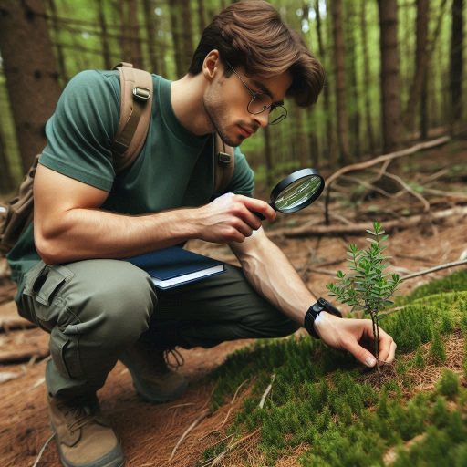
Ecological research focuses on understanding ecosystems and the relationships among organisms and their environments.
Scientists study biodiversity, habitat dynamics, and the impact of human activities.
This research provides crucial insights into how ecosystems function and respond to changes.
Technological advancements have significantly enhanced ecological research methodologies.
These innovations improve data collection, analysis, and interpretation, allowing researchers to make informed decisions.
Tools like drones and satellite imagery offer new ways to monitor ecosystems from different perspectives.
Additionally, environmental sensors and IoT devices provide real-time data on air and water quality.
Machine learning and artificial intelligence enable researchers to analyze large datasets effectively.
This analysis leads to better predictions about ecosystem responses to climate change and other threats.
The integration of technologies also fosters public engagement in ecological issues.
Virtual reality and augmented reality create immersive educational experiences, raising awareness about environmental challenges.
Overall, these technological advancements are vital for advancing ecological research and promoting sustainable practices.
They empower scientists to address pressing environmental issues and develop effective conservation strategies.
Drones in Ecological Research
How Drones Are Being Used to Map and Monitor Ecosystems
Drones have revolutionized ecological research in recent years.
Their versatility makes them valuable tools for mapping and monitoring ecosystems.
Researchers utilize drones to collect data across various landscapes, including forests, wetlands, and mountains.
They capture high-resolution aerial images and videos, providing detailed insights into environmental changes.
By flying over specific areas, drones can monitor wildlife populations and assess habitat conditions.
One significant application of drones is ecosystem mapping.
Traditional mapping methods can be time-consuming and labor-intensive.
Drones simplify this process, allowing researchers to cover large areas quickly.
Equipped with advanced sensors, drones collect valuable data, including topography, vegetation cover, and water bodies.
This data helps scientists create detailed maps that inform conservation efforts and land management strategies.
Drones also excel in monitoring ecosystems over time.
Researchers can conduct repeated surveys to track changes in vegetation, land use, and wildlife habitats.
By comparing data collected from different time points, scientists can identify trends and assess the impact of environmental changes.
This longitudinal data is crucial for understanding how ecosystems respond to disturbances such as climate change or human activity.
Benefits of Using Drones for Data Collection in Remote and Inaccessible Areas
One major advantage of drones is their ability to access remote and inaccessible areas.
Many ecosystems are located in difficult-to-reach locations, making traditional data collection challenging.
Drones eliminate this barrier, enabling researchers to gather data in places that would otherwise be unsafe or impossible to access.
For example, scientists can study fragile alpine ecosystems or dense rainforests without disrupting the environment.
Additionally, drones minimize the physical disturbance to ecosystems during data collection.
Unlike traditional survey methods, which may require extensive ground access, drones operate from the air.
This non-invasive approach protects sensitive habitats and reduces the risk of impacting wildlife behavior.
Drones provide a more ethical means of conducting research in vulnerable ecosystems.
Using drones for data collection offers several benefits.
They provide real-time data, allowing researchers to make timely decisions.
This immediacy enhances the ability to respond to environmental changes or emergencies.
Drones also increase efficiency, reducing the time and labor involved in data collection.
This efficiency allows researchers to focus on data analysis and interpretation rather than logistics.
Moreover, drones can operate in diverse weather conditions.
They can fly in light rain and wind, which often limits traditional fieldwork.
This adaptability expands the potential for ecological research, ensuring that data collection can occur throughout the year.
Drones have transformed ecological research by providing innovative solutions for mapping and monitoring ecosystems.
Their ability to access remote areas, minimize ecological disturbance, and deliver real-time data enhances research capabilities.
As technology continues to evolve, drones will likely play an even more significant role in ecological studies, fostering a deeper understanding of our planet’s ecosystems.
Satellite Imagery and GIS Technology
Role of Satellite Imagery in Tracking Changes in Biodiversity
Satellite imagery plays a crucial role in ecological research.
It provides a comprehensive view of Earth’s surface.
Researchers use this technology to track changes in biodiversity over time.
Satellites capture images that reveal vegetation patterns and habitat types.
This data allows scientists to monitor ecosystems on a large scale.
By analyzing satellite images, researchers can identify areas of biodiversity loss.
They can observe habitat destruction due to urban development or agriculture.
This information helps in assessing the impact of human activities on natural ecosystems.
Furthermore, satellite imagery supports conservation efforts by identifying critical habitats.
Protecting these areas is essential for maintaining biodiversity.
Satellite imagery also enhances our understanding of climate change.
It provides data on shifts in vegetation and animal populations.
Researchers can monitor how climate change affects species distribution.
This information is vital for developing effective conservation strategies.
Moreover, satellite technology can track seasonal changes in ecosystems.
Scientists can observe how plants and animals respond to changing conditions.
This data is crucial for understanding ecological dynamics.
Researchers can identify trends in blooming periods and animal migrations.
Such insights inform conservation planning and policy decisions.
Use of Geographic Information Systems (GIS) for Spatial Analysis in Ecological Research
Geographic Information Systems (GIS) complement satellite imagery in ecological research.
GIS technology allows researchers to analyze spatial data effectively.
It integrates various data sources, including satellite imagery, terrain data, and species distribution maps.
This integration enhances researchers’ ability to visualize and understand complex ecological patterns.
Using GIS, researchers can conduct spatial analyses to identify biodiversity hotspots.
They can map areas with high species richness or unique ecosystems.
This information aids conservation efforts by prioritizing areas for protection.
GIS also enables scientists to assess the impacts of environmental changes.
By analyzing spatial relationships, researchers can identify factors contributing to biodiversity loss.
Additionally, GIS technology facilitates habitat modeling.
Researchers can predict how species will respond to environmental changes.
This modeling helps in identifying potential threats to biodiversity.
By understanding these threats, conservationists can implement proactive measures.
GIS also plays a significant role in land-use planning.
It helps decision-makers evaluate the environmental impact of proposed developments.
By visualizing potential changes, planners can make informed decisions that protect ecosystems.
GIS allows for the evaluation of alternative scenarios to minimize environmental harm.
Furthermore, GIS technology enhances collaboration among researchers.
It provides a platform for sharing data and findings.
This collaborative approach fosters interdisciplinary research and improves conservation strategies.
By combining efforts, scientists can address complex ecological challenges more effectively.
Satellite imagery and GIS technology significantly impact ecological research.
Satellite imagery tracks changes in biodiversity, while GIS provides powerful tools for spatial analysis.
Together, they enhance our understanding of ecosystems and inform conservation efforts.
As technology advances, these tools will continue to play vital roles in protecting our planet’s biodiversity.
Read: US Chemistry Conferences and Symposiums to Attend in 2024
DNA Sequencing for Biodiversity Studies
Impact of DNA Sequencing on Understanding Species Diversity and Interactions
DNA sequencing has transformed our understanding of biodiversity.
It allows researchers to identify species at a molecular level.
Traditional identification methods often rely on physical characteristics.
These methods can be time-consuming and sometimes inaccurate.
DNA sequencing provides a precise and reliable approach to species identification.
By analyzing genetic material, scientists can uncover hidden species.
Many organisms look similar but belong to different species.
DNA sequencing helps reveal these cryptic species, enhancing our knowledge of biodiversity.
Furthermore, it enables researchers to study species interactions in ecosystems.
Understanding these interactions is essential for conservation efforts.
DNA sequencing also aids in understanding genetic diversity within populations.
Genetic diversity is crucial for species’ survival and adaptability.
By assessing genetic variation, scientists can identify populations at risk.
This information helps prioritize conservation actions to protect vulnerable species.
Additionally, DNA sequencing helps monitor ecosystem health.
Changes in species composition can indicate environmental shifts.
By analyzing genetic data, researchers can detect these changes early.
This proactive approach allows for timely interventions to protect ecosystems.
Examples of How DNA Barcoding Is Revolutionizing Ecological Research
DNA barcoding is a specific application of DNA sequencing.
It uses short, standardized gene regions to identify species.
This method has revolutionized ecological research by simplifying species identification.
Researchers can collect samples from various locations and quickly identify species using DNA barcoding.
One notable example of DNA barcoding in action is its use in biodiversity assessments.
Scientists have conducted extensive studies in tropical rainforests.
They collected leaf samples and identified plant species through DNA barcoding.
This approach revealed a much higher diversity of species than previously documented.
Such findings are crucial for conservation efforts in these biodiverse regions.
Another significant application of DNA barcoding is in monitoring invasive species.
Invasive species can disrupt local ecosystems and threaten native biodiversity.
Researchers can collect environmental samples, such as soil or water, to detect invasive species using DNA barcoding.
This method allows for rapid identification and timely management of invasive populations.
DNA barcoding also aids in understanding food webs.
Researchers can analyze the dietary habits of predators by examining their feces.
By identifying prey species through DNA barcoding, scientists can gain insights into ecological interactions.
This understanding helps in assessing ecosystem dynamics and stability.
Moreover, DNA barcoding facilitates the study of microbial diversity.
Microorganisms play vital roles in ecosystem functioning.
By applying DNA barcoding techniques, researchers can uncover the diversity of microbial communities.
This knowledge enhances our understanding of ecosystem processes, such as nutrient cycling and decomposition.
DNA sequencing and barcoding have revolutionized biodiversity studies.
They provide precise methods for species identification and enhance our understanding of ecological interactions.
As these techniques continue to evolve, they will play an increasingly vital role in conservation and ecological research.
Read: Key Roles and Responsibilities of a Chemist in the US
Artificial Intelligence and Machine Learning
Applications of AI and Machine Learning in Analyzing Large Datasets in Ecology
Artificial intelligence (AI) and machine learning (ML) are transforming ecological research.
They enable scientists to analyze vast datasets efficiently.
Ecologists often collect large amounts of data from various sources, such as satellite imagery, field surveys, and sensor networks.
Traditional analysis methods can be slow and labor-intensive.
AI and ML streamline this process, revealing patterns and insights quickly.
One significant application of AI in ecology is species identification.
Machine learning algorithms can process images and recognize species based on features.
Researchers can upload thousands of photographs, allowing AI to identify species automatically.
This technology accelerates biodiversity assessments and improves data accuracy.
AI also assists in monitoring animal behavior.
By analyzing video footage, machine learning models can track animal movements.
This analysis helps researchers understand animal interactions and habitat use.
It provides valuable insights into behavioral ecology and conservation strategies.
Another important application is predicting species distribution.
Machine learning algorithms analyze environmental variables and historical data to forecast where species might thrive.
This capability helps scientists identify areas at risk of losing biodiversity.
Early detection enables conservationists to implement protective measures in vulnerable regions.
AI can also optimize ecological modeling.
Traditional models often rely on simplified assumptions.
Machine learning allows researchers to create more complex models that account for various factors.
These advanced models improve our understanding of ecological dynamics and interactions.
How These Technologies Are Aiding in Predicting Ecosystem Responses to Climate Change
AI and ML are invaluable for predicting ecosystem responses to climate change.
Climate change poses significant threats to ecosystems and biodiversity.
Researchers need effective tools to assess these impacts and plan interventions.
Machine learning can analyze climate data and ecological responses simultaneously.
By examining historical data, researchers can identify trends and patterns related to climate variables.
This analysis helps predict how ecosystems will respond to future climate scenarios.
For example, AI models can forecast changes in plant phenology, such as flowering times.
Understanding these shifts is crucial for predicting ecosystem interactions.
Changes in flowering times can impact pollinator behavior and food availability for herbivores.
Additionally, AI can enhance habitat suitability modeling.
By incorporating climate projections, machine learning algorithms can predict shifts in suitable habitats for various species.
This information is essential for developing conservation strategies that anticipate changes in species distributions.
Moreover, AI can analyze complex interactions among species in changing environments.
By modeling these interactions, researchers can assess potential ecosystem disruptions.
Understanding these dynamics helps conservationists develop effective management plans.
AI and machine learning also support adaptive management strategies.
By continuously analyzing new data, these technologies can refine predictions over time.
This adaptability allows researchers to respond proactively to emerging ecological challenges.
AI and machine learning are revolutionizing ecological research.
They enhance our ability to analyze large datasets and predict ecosystem responses to climate change.
As these technologies advance, they will play an increasingly vital role in conservation and ecological management efforts.
Read: Earning Potential: Chemist Salaries Across US States

Remote Sensing Tools for Monitoring Environmental Changes
Overview of Remote Sensing Technologies Like LiDAR and Thermal Imaging
Remote sensing technologies have revolutionized environmental monitoring.
They allow researchers to gather data without direct contact with the environment.
Two prominent remote sensing tools are LiDAR and thermal imaging.
LiDAR, or Light Detection and Ranging, uses laser pulses to measure distances.
It creates high-resolution, three-dimensional maps of landscapes.
Researchers can identify vegetation types, tree heights, and ground topography using LiDAR data.
This precision is invaluable for studying forest structures and biodiversity.
Thermal imaging captures the heat emitted by objects on the Earth’s surface.
This technology reveals temperature variations, which can indicate changes in land cover.
By analyzing thermal data, researchers can monitor surface temperatures of water bodies and urban areas.
This information helps assess environmental health and climate impacts.
Both LiDAR and thermal imaging are non-invasive.
They allow scientists to collect data over vast areas quickly and efficiently.
These tools can penetrate dense vegetation, providing insights into hidden features and conditions.
How These Tools Are Used to Monitor Deforestation, Land Use Changes, and Other Environmental Threats
Remote sensing tools play a crucial role in monitoring deforestation.
By comparing satellite imagery over time, researchers can track changes in forest cover.
LiDAR data enhances this analysis by revealing forest structure and biomass.
This information helps identify areas experiencing rapid deforestation.
Monitoring land use changes is another critical application.
Remote sensing technologies can differentiate between various land uses, such as agriculture, urban development, and natural habitats.
Researchers can analyze spatial data to understand how human activities impact ecosystems.
This understanding is vital for sustainable land management.
Additionally, remote sensing aids in detecting environmental threats.
For instance, researchers use thermal imaging to monitor wildfires.
This technology helps identify hotspots, allowing for rapid response and containment.
By detecting fires early, scientists can minimize damage to ecosystems.
Remote sensing tools also monitor wetland health.
Researchers can assess water levels and vegetation patterns using satellite imagery.
This data is essential for managing wetlands, which provide vital ecosystem services.
By tracking changes in wetlands, scientists can identify potential threats and implement conservation measures.
Furthermore, these technologies facilitate the monitoring of climate change impacts.
Researchers analyze shifts in land cover, temperature, and precipitation patterns over time.
This analysis helps identify vulnerable ecosystems and assess adaptation strategies.
Remote sensing technologies enhance collaboration among researchers and policymakers.
By providing accessible data, these tools promote informed decision-making.
Policymakers can develop effective conservation strategies based on accurate information.
Remote sensing tools like LiDAR and thermal imaging are essential for monitoring environmental changes.
They provide precise, non-invasive data for tracking deforestation, land use changes, and other environmental threats.
As technology advances, remote sensing will play an increasingly vital role in conservation and environmental management efforts.
Read: Top Chemistry Departments and Schools in the US
You Might Also Like: Publishing in Seismology: Journals and Guidelines
Environmental Sensors and Internet of Things (IoT) Devices
Role of Environmental Sensors in Real-Time Monitoring of Air and Water Quality
Environmental sensors play a critical role in monitoring air and water quality.
They provide real-time data essential for assessing environmental health.
These sensors detect pollutants, temperature, humidity, and other vital parameters.
This information helps researchers identify trends and potential hazards in ecosystems.
Air quality sensors measure pollutants like particulate matter, carbon dioxide, and nitrogen dioxide.
By continuously monitoring these pollutants, scientists can assess the impact on human health and ecosystems.
Timely data allows for immediate action in response to hazardous air quality levels.
Water quality sensors monitor parameters such as pH, turbidity, and dissolved oxygen.
They provide insights into the health of aquatic ecosystems.
These sensors help detect contaminants and track changes over time.
Researchers can identify pollution sources and assess the effectiveness of mitigation efforts.
Real-time monitoring also enhances public awareness.
Communities can access air and water quality data through various platforms.
This transparency encourages environmental stewardship and informed decision-making among citizens.
How IoT Devices Are Revolutionizing Ecological Research by Collecting Continuous Data from Various Ecosystems
The Internet of Things (IoT) revolutionizes ecological research through continuous data collection.
IoT devices connect sensors to the internet, enabling seamless data transmission.
Researchers can monitor ecosystems in real time, enhancing their understanding of environmental dynamics.
IoT devices facilitate the integration of diverse data sources.
For example, scientists can combine weather data, soil moisture levels, and biodiversity metrics.
This integration allows for comprehensive analyses of ecosystem health.
Researchers can identify correlations between various factors impacting ecosystems.
One significant application of IoT devices is wildlife monitoring.
Researchers deploy IoT-enabled cameras and GPS collars to track animal movements.
These devices provide valuable insights into behavior, migration patterns, and habitat use.
Understanding these dynamics is crucial for effective conservation strategies.
Moreover, IoT devices support precision agriculture.
Farmers use environmental sensors to monitor soil moisture and nutrient levels.
This data enables them to optimize irrigation and fertilization.
As a result, they enhance crop yields while minimizing environmental impacts.
In urban environments, IoT devices monitor green spaces and urban ecosystems.
They track plant health, soil conditions, and biodiversity.
This data informs urban planning and green infrastructure development.
Cities can make data-driven decisions to enhance sustainability.
IoT devices also improve disaster response efforts.
For instance, sensors can detect flood levels in real time.
This information allows for timely evacuations and resource allocation.
Such proactive measures can save lives and protect ecosystems during natural disasters.
Furthermore, IoT technology fosters collaboration among researchers.
Data collected from various ecosystems can be shared across platforms.
This collaboration promotes interdisciplinary research and enhances understanding of global environmental challenges.
Environmental sensors and IoT devices are transforming ecological research.
They enable real-time monitoring of air and water quality, providing critical data for conservation.
As these technologies advance, they will play a vital role in protecting and understanding our planet’s ecosystems.
See Related Content: Materials Science vs. Other Science Disciplines
Virtual Reality and Augmented Reality for Ecological Education
Use of VR and AR Technologies in Creating Immersive Experiences for Learning About Ecosystems
Virtual reality (VR) and augmented reality (AR) technologies have transformed ecological education.
They create immersive experiences that engage learners in unique ways.
By simulating real-world environments, these technologies enhance understanding of complex ecosystems.
With VR, users can explore diverse habitats without leaving their homes.
They can dive into coral reefs, wander through rainforests, or roam deserts.
This immersion fosters a deeper appreciation for biodiversity and ecological interconnections.
Learners experience firsthand the beauty and fragility of ecosystems.
AR enhances traditional learning by overlaying digital information onto the real world.
For instance, students can point a device at a plant and see detailed information about its ecosystem.
This interactive approach makes learning more engaging and memorable.
It encourages curiosity and exploration of the natural world.
Educators can use VR and AR to simulate ecological processes.
Students can observe how food webs function or how ecosystems respond to changes.
These simulations provide insights into ecological balance and the impact of human activities.
Additionally, these technologies can help illustrate environmental issues.
For example, users can witness the effects of deforestation or climate change in real time.
This visual representation drives home the urgency of these issues.
It allows learners to understand the consequences of their actions.
Potential for These Technologies to Increase Public Awareness and Engagement with Environmental Issues
VR and AR have significant potential to increase public awareness of environmental issues.
By offering immersive experiences, they evoke emotional responses and drive engagement.
People are more likely to connect with environmental challenges when they experience them firsthand.
Public exhibitions and events utilizing VR and AR attract diverse audiences.
They provide interactive experiences that appeal to all ages.
Participants can explore ecosystems and learn about conservation efforts in an engaging format.
This approach fosters a sense of responsibility for environmental stewardship.
Moreover, these technologies can reach individuals who may not engage with traditional education methods.
For instance, urban communities can explore local ecosystems through AR applications.
This access helps bridge the gap between urban and natural environments.
It encourages people to appreciate and protect their local ecosystems.
Organizations can also use VR and AR for advocacy campaigns.
They can create compelling narratives around conservation initiatives.
By sharing immersive stories, they inspire individuals to take action.
This narrative-driven approach makes environmental issues relatable and urgent.
Furthermore, schools and universities can integrate VR and AR into their curricula.
By enhancing ecological education, they prepare future generations to tackle environmental challenges.
Students become informed advocates for sustainability, armed with knowledge and empathy.
Virtual reality and augmented reality are powerful tools for ecological education.
They create immersive learning experiences and raise awareness about environmental issues.
By engaging the public in meaningful ways, these technologies foster a culture of environmental stewardship and responsibility.
Discover More: Neuroscience: Key Areas of Research Explained
Conclusion
Technologies are significantly transforming ecological research.
Drones, satellite imagery, and IoT devices enhance data collection and monitoring efforts.
Environmental sensors provide real-time data on air and water quality.
AI and machine learning analyze large datasets to predict ecosystem responses to climate change.
Virtual and augmented reality engage the public in ecological education and awareness.
The integration of DNA sequencing enables researchers to understand species diversity and interactions better.
These advancements allow scientists to address complex ecological challenges more effectively.
As technology continues to evolve, its application in ecology will expand further.
Future developments will likely focus on improving data accessibility and enhancing collaboration among researchers.
Innovations such as improved machine learning algorithms and advanced remote sensing tools will drive research capabilities.
The fusion of technology and ecology will empower scientists to develop targeted conservation strategies.
Ultimately, the ongoing integration of technology into ecological research holds great promise.
It will enable more effective monitoring, better data analysis, and increased public engagement in environmental issues.
The future of ecology will rely on innovative technological solutions to protect our planet.