Introduction
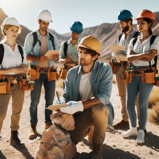
Geology is the scientific study of Earth’s materials, structures, and processes.
It helps us understand how our planet formed and evolved.
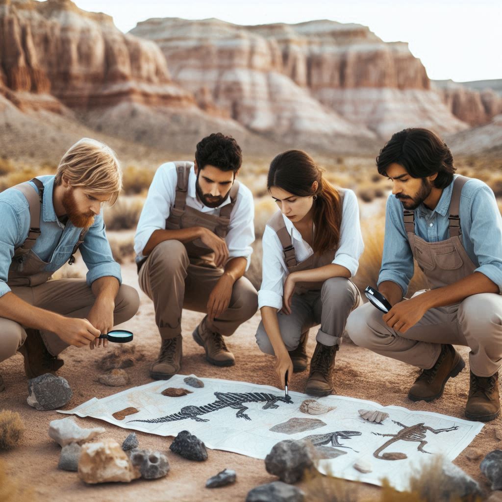
Geologists examine rocks, minerals, and fossils to unravel Earth’s history.
Their work is crucial for resource management, environmental protection, and hazard assessment.
Understanding geological processes is essential for sustainable development.
It informs decisions regarding land use, resource extraction, and environmental conservation.
Geologists play a vital role in addressing challenges like climate change and natural disasters.
Technology has revolutionized the field of geology in many ways.
Advanced tools and techniques allow geologists to gather more accurate data.
Geographic Information Systems (GIS) enable detailed mapping and analysis of geological features.
Remote sensing technology captures data from satellites, providing valuable insights into Earth’s surface.
3D modeling software helps visualize subsurface structures and processes.
These innovations enhance our understanding of geological formations and their behavior.
Furthermore, data analytics tools allow geologists to analyze large datasets quickly and efficiently.
Drones and automated equipment facilitate fieldwork, reducing the time needed for surveys.
Overall, technology has transformed geology into a more precise and efficient science.
These advancements empower geologists to address complex geological challenges effectively and responsibly.
Advancements in Remote Sensing Technology
Satellites and Drones in Remote Sensing for Geology
Satellites and drones have revolutionized remote sensing in geology.
They provide valuable data about the Earth’s surface from high altitudes.
Satellites capture large-scale images, covering vast areas in a short time.
They use various sensors to measure electromagnetic radiation reflected from the Earth.
Drones, or unmanned aerial vehicles (UAVs), offer flexibility and precision.
They can fly lower and capture high-resolution images.
Geologists use drones to inspect hard-to-reach areas, such as cliffs and remote locations.
This capability enhances data collection efficiency and safety.
Both satellites and drones gather multispectral and hyperspectral data.
These data types reveal information about surface materials and vegetation.
Geologists analyze these data to identify minerals, soil types, and land use.
Remote sensing technologies allow for monitoring changes over time, providing critical insights into geological processes.
In addition, satellites provide real-time data on natural disasters.
They help track events like earthquakes, landslides, and floods.
This information is vital for disaster response and recovery efforts.
Drones can also assess damage after a disaster, providing detailed imagery for analysis.
Improved Geological Surveys and Mapping Through Remote Sensing
Remote sensing technology has significantly improved geological surveys and mapping.
It allows for faster data collection compared to traditional methods.
Geologists can cover large areas efficiently without extensive fieldwork.
One notable example is mineral exploration.
Remote sensing helps geologists locate mineral deposits more effectively.
They can identify surface mineralogy using spectral data from satellites and drones.
This technology reduces the need for extensive ground surveys.
Geological mapping has also benefited from remote sensing.
High-resolution satellite imagery provides detailed maps of landforms and geological features.
Geologists can analyze these maps to understand regional geology better.
This understanding aids in resource management and land-use planning.
Furthermore, remote sensing enhances geological hazard assessments.
Geologists can monitor land subsidence, slope stability, and coastal erosion.
These assessments help communities prepare for natural disasters and mitigate risks.
Remote sensing technologies allow for continuous monitoring of geological changes.
Geologists can track changes in glacial melt, vegetation patterns, and soil erosion.
This data provides insights into climate change impacts on geological processes.
Another example is the use of LiDAR (Light Detection and Ranging) technology.
LiDAR provides precise topographic data, revealing subtle landforms.
Geologists use LiDAR to study geological features like fault lines and landslide areas.
This technology enhances the accuracy of geological models and predictions.
Moreover, remote sensing improves archaeological surveys.
Geologists can identify potential archaeological sites without invasive excavation.
This non-destructive approach preserves historical sites while advancing geological understanding.
Advancements in remote sensing technology have transformed geology.
Satellites and drones enable efficient data collection, improving geological surveys and mapping.
By utilizing these technologies, geologists gain valuable insights into the Earth’s processes and resources.
This progress enhances decision-making and fosters sustainable management of natural resources.
Read: Profiles in Success: Leading Chemists of the 21st Century in the US
Use of Geographic Information Systems (GIS) in Geology
How GIS Helps Geologists Analyze and Visualize Data
Geographic Information Systems (GIS) significantly enhance how geologists analyze and visualize data.
GIS integrates various data types into a cohesive platform.
This technology allows geologists to create detailed maps and models of geological features.
By visualizing complex data, GIS helps scientists identify patterns and relationships.
GIS enables geologists to overlay multiple layers of information.
For example, they can combine geological maps with topographical data.
This integration provides insights into how geology interacts with landforms.
Geologists can analyze spatial relationships and assess environmental impacts more effectively.
Moreover, GIS allows for real-time data analysis.
Geologists can update maps and models as new data becomes available.
This capability enhances decision-making processes in fieldwork and research.
GIS also supports data sharing among researchers, improving collaboration across disciplines.
Geologists can conduct spatial analysis using GIS tools.
They can identify trends, calculate distances, and assess area characteristics.
These analytical capabilities facilitate better planning for resource management and environmental protection.
GIS also assists in creating predictive models to forecast geological events.
Examples of How GIS Has Been Used in Geological Studies
GIS has been instrumental in various geological studies.
One prominent application involves identifying mineral deposits.
By analyzing geospatial data, geologists can pinpoint areas with high mineral potential.
GIS allows them to overlay geological maps with satellite imagery.
This combination reveals surface features that indicate mineralization.
In one study, geologists used GIS to explore gold deposits in a specific region.
They integrated geochemical data, topographic maps, and historical mining records.
This analysis identified promising sites for further exploration, leading to successful mining operations.
GIS also plays a crucial role in mapping fault lines.
Geologists utilize GIS to analyze seismic data and historical earthquake occurrences.
By mapping fault lines accurately, they can assess earthquake risks in specific areas.
This information is vital for urban planning and disaster preparedness.
Another example involves groundwater studies.
Geologists use GIS to map aquifers and their recharge areas.
This mapping helps identify potential contamination sources and develop management strategies.
GIS aids in visualizing groundwater flow and predicting changes over time.
Furthermore, GIS supports environmental impact assessments.
Geologists can evaluate how geological features influence land use and development.
By visualizing the relationship between geology and human activities, they can inform better land-use planning.
GIS plays a crucial role in modern geological studies.
It helps geologists analyze and visualize complex data effectively.
Through examples like identifying mineral deposits and mapping fault lines, GIS demonstrates its value in advancing geological research.
This technology enhances decision-making processes and promotes sustainable resource management.
The integration of GIS into geology marks a significant advancement in understanding Earth’s systems and resources.
Read: The Life and Times of a U.S. Physicist: A Day in Detail
3D Modeling and Simulation in Geology
How 3D modeling software is used to create accurate representations of geological features
Advancements in technology have transformed geology.
One significant innovation is 3D modeling software.
Geologists use this software to create detailed representations of geological features.
These models visualize subsurface structures, rock formations, and mineral deposits.
By integrating various data sources, geologists can produce accurate and informative models.
3D modeling software combines geological data from surveys and drilling.
This integration allows for the visualization of complex geological formations.
Geologists can manipulate the models to explore different scenarios.
They can simulate various geological processes and their effects over time.
This capability enhances their understanding of the geological environment.
Additionally, these models improve communication among professionals.
Engineers, architects, and environmental scientists can visualize geological data together.
This collaboration helps identify potential challenges early in a project.
It also allows for informed decision-making regarding site selection and construction methods.
Moreover, 3D models facilitate education and training.
Students can interact with realistic geological representations.
This hands-on approach enhances their learning experience.
It prepares them for real-world applications in geology and related fields.
Benefits of using simulation technology for predicting natural hazards like earthquakes and landslides
Simulation technology offers significant benefits for predicting natural hazards.
Geologists use advanced simulations to model geological processes.
These simulations help assess the likelihood of events such as earthquakes and landslides.
By analyzing historical data, scientists can create scenarios that mimic potential hazards.
For instance, simulation technology allows for seismic modeling.
Geologists simulate tectonic plate movements to predict earthquake risks.
This information is crucial for urban planning and infrastructure design.
Communities can use these predictions to enhance their preparedness for seismic events.
Similarly, simulation technology aids in landslide risk assessment.
Geologists can model slope stability under various conditions.
By analyzing factors like rainfall and soil composition, they can identify vulnerable areas.
This information helps inform land-use planning and mitigation strategies.
Another benefit is the ability to test different scenarios.
Scientists can adjust parameters in simulations to understand their impact.
This capability provides valuable insights into how natural hazards may evolve.
Geologists can identify potential triggers and consequences of these events.
Furthermore, these simulations support emergency response planning.
Authorities can develop effective evacuation routes and emergency protocols.
By understanding potential hazards, communities can enhance their resilience to disasters.
Advancements in technology have greatly benefited geology.
3D modeling software enables accurate representations of geological features.
This technology enhances collaboration and education.
Meanwhile, simulation technology improves predictions of natural hazards.
By modeling processes like earthquakes and landslides, geologists contribute to safer communities.
As technology continues to evolve, its applications in geology will only expand, providing even greater insights and solutions.
Read: Salary Ranges: What to Expect as a Physicist in the USA
Advancements in Ground Penetrating Radar (GPR)
How GPR Technology is Used to Explore Subsurface Geology
Ground Penetrating Radar (GPR) technology revolutionizes how scientists explore subsurface geology.
GPR uses electromagnetic waves to detect underground features.
These waves penetrate the ground and reflect off different materials.
By analyzing these reflections, geologists can create detailed images of subsurface structures.
GPR technology offers several advantages over traditional methods.
It provides real-time data, allowing for immediate analysis.
This speed facilitates quicker decision-making in field studies.
Additionally, GPR is non-invasive and environmentally friendly.
It does not disturb the ground, preserving the integrity of the site.
Geologists employ GPR in various geological surveys.
They use it to locate bedrock, identify soil layers, and map geological formations.
GPR also aids in detecting faults and fractures, which are crucial for assessing geological hazards.
This technology enhances our understanding of subsurface conditions, leading to safer construction and land-use planning.
The versatility of GPR extends beyond geology.
It can adapt to different environments, including urban, rural, and remote areas.
This flexibility allows scientists to conduct surveys in various conditions, making GPR a valuable tool in many fields.
Examples of GPR Use in Archaeological Studies
GPR has gained popularity in archaeological studies due to its effectiveness.
Archaeologists use GPR to locate buried artifacts and structures.
The technology reveals features that are not visible on the surface.
This capability allows researchers to explore historical sites without excavation.
For instance, GPR helped uncover the remains of ancient structures in Italy.
Archaeologists detected walls, roads, and foundations without disturbing the ground.
This non-invasive approach preserved the integrity of the site while providing valuable data.
Another notable example is the use of GPR at the ancient Mayan city of Caracol in Belize.
Researchers mapped the extensive city layout and identified hidden buildings.
This discovery shed light on the urban planning and complexity of ancient Mayan civilization.
GPR has also assisted in locating burial sites.
Archaeologists use this technology to identify graves and tombs without disturbing them.
By mapping subsurface anomalies, they can determine potential burial locations.
This method ensures respect for cultural heritage while allowing for further study.
Detecting Underground Water Sources
GPR technology is highly effective in detecting underground water sources.
Hydrologists utilize GPR to map aquifers and groundwater reservoirs.
This mapping helps identify potential water sources for communities and agriculture.
For example, GPR has successfully located groundwater in arid regions.
Researchers detected subsurface water using GPR surveys, providing essential information for sustainable water management.
This technology enables communities to secure water supplies and reduce reliance on surface water.
Moreover, GPR aids in environmental assessments.
Scientists use it to identify contamination plumes in groundwater.
This information is crucial for developing remediation strategies and protecting water resources.
GPR technology significantly advances our understanding of subsurface geology.
Its applications in geological exploration, archaeology, and water resource detection are invaluable.
As GPR technology continues to evolve, it will enhance our ability to study and manage our natural resources effectively.
Read: Physics Specializations: Choosing Your Path in the U.S.
See Related Content: Women Making Waves in Plant Science
Impact of Big Data and Machine Learning in Geology
Geologists Using Big Data Analytics and Machine Learning
Geologists increasingly use big data analytics and machine learning.
These technologies help analyze vast datasets quickly and efficiently.
Geologists can identify patterns that were previously difficult to detect.
This ability enhances their understanding of geological processes.
Big data analytics allows geologists to process information from various sources.
These sources include satellite imagery, seismic data, and geological maps.
By integrating these datasets, geologists gain a comprehensive view of the Earth‘s systems.
This holistic approach improves their ability to make informed decisions.
Machine learning algorithms further enhance data analysis.
These algorithms can recognize complex patterns and relationships within large datasets.
Geologists use these insights to improve their predictive models.
For example, machine learning can analyze historical earthquake data to forecast future events.
Moreover, machine learning helps geologists refine resource exploration techniques.
They can predict the location of mineral deposits with higher accuracy.
This precision reduces exploration costs and minimizes environmental impact.
In summary, big data analytics and machine learning revolutionize geology.
These technologies enable geologists to analyze large datasets effectively.
Predicting Geological Events and Assessing Environmental Risks
Geologists apply advanced technologies to predict geological events.
For instance, they use machine learning to analyze seismic data.
By examining past earthquake patterns, they can forecast potential tremors.
This predictive capability is crucial for disaster preparedness.
In addition, geologists use big data to monitor volcanic activity.
They analyze gas emissions, ground deformation, and thermal data.
These analyses help predict eruptions, providing early warnings to affected communities.
Timely alerts can save lives and minimize damage.
Another example involves landslide risk assessment.
Geologists collect data on rainfall, soil moisture, and slope stability.
They apply machine learning algorithms to predict landslide occurrences.
This predictive model helps communities prepare and implement safety measures.
Geologists also assess environmental risks related to climate change.
They analyze data on sea-level rise, erosion, and habitat loss.
By identifying vulnerable areas, they guide conservation efforts and land-use planning.
This proactive approach reduces potential impacts on ecosystems.
Furthermore, big data analytics aids in groundwater management.
Geologists study patterns in water quality and availability.
This information is vital for sustainable water resource management.
They can predict changes in groundwater levels due to climate fluctuations.
On a final note, geologists leverage technology to enhance predictions and risk assessments.
Big data analytics and machine learning improve their ability to foresee geological events.
These advancements contribute significantly to environmental safety and sustainability.
As technology continues to evolve, geologists will further enhance their understanding of Earth processes.
This progress will ultimately benefit society as a whole.
You Might Also Like: A Day in the Life of a Meteorologist: What to Expect
Collaboration and Communication in the Digital Age
How Digital Tools Such as Online Platforms and Virtual Reality Have Enhanced Collaboration Among Geologists
Advancements in technology have transformed geology into a more collaborative field.
Digital tools, such as online platforms and virtual reality, facilitate communication among geologists.
These tools allow professionals to share data and insights in real-time.
Online platforms enable geologists to work together regardless of geographical distance.
Virtual reality (VR) offers immersive experiences for geological training and collaboration.
Geologists can explore virtual environments, simulating real-world geological features.
This technology enhances understanding and promotes teamwork on complex projects.
Virtual field trips provide opportunities for geologists to study remote locations without traveling.
Additionally, cloud-based storage systems allow teams to access and analyze data from anywhere.
This flexibility enhances collaboration and fosters innovation.
Geologists can upload, share, and modify data in real time.
Online discussion forums and webinars also create spaces for exchanging ideas and best practices.
Moreover, Geographic Information Systems (GIS) enable geologists to visualize data effectively.
GIS tools help map geological features, enhancing analysis and decision-making.
By integrating various data sources, geologists can collaborate more efficiently.
This technology allows for better project planning and management.
Examples of How Geologists from Different Parts of the World Are Working Together on Large-Scale Projects Using Technology
Geologists worldwide collaborate on large-scale projects, thanks to technological advancements.
For instance, the Global Earthquake Model (GEM) initiative brings together scientists from multiple countries.
This project aims to improve earthquake risk assessment through shared data and research.
Another example is the International Ocean Discovery Program (IODP).
This initiative involves geologists from various countries studying the Earth‘s history through ocean drilling.
Teams use online platforms to share findings and coordinate research efforts.
This collaboration leads to a better understanding of climate change and geological processes.
In addition, the European Geosciences Union (EGU) organizes international conferences that leverage technology.
These events allow geologists to present research virtually, enabling global participation.
Researchers share insights and findings across borders, promoting collaboration.
Moreover, the Global Monitoring for Environment and Security (GMES) program uses satellite technology to monitor environmental changes.
Geologists contribute to this initiative by analyzing satellite data for geological applications.
This collaboration fosters international partnerships and enhances understanding of global geological processes.
The use of drones in geological surveys is another example of technological collaboration.
Geologists from different regions utilize drones to collect data efficiently.
These unmanned aerial vehicles capture high-resolution images and survey inaccessible areas.
By sharing this data, geologists enhance their research and promote cross-border collaboration.
advancements in technology have significantly enhanced collaboration among geologists.
Digital tools, online platforms, and virtual reality facilitate communication and data sharing.
Geologists from around the world work together on large-scale projects, improving our understanding of geological processes.
Through technology, they can address complex challenges and make impactful contributions to the field of geology.
Conclusion
Technology has revolutionized the field of geology in many ways.
Advanced tools like GIS and remote sensing have transformed data collection.
These technologies enable geologists to analyze vast areas quickly and efficiently.
Drones equipped with cameras provide detailed imagery of hard-to-reach locations.
Moreover, 3D modeling software allows for precise visualizations of geological formations.
These models help researchers understand subsurface structures better than ever.
Additionally, data analytics has improved the interpretation of complex geological information.
Machine learning algorithms can identify patterns in large datasets, accelerating discoveries.
Fieldwork has also evolved with technological advancements.
Portable devices and applications streamline data collection in remote areas.
These innovations enhance accuracy and reduce the time required for analysis.
Continued advancements in technology are essential for furthering our understanding of Earth’s geological processes.
As new tools emerge, geologists can explore uncharted territories and reveal hidden geological features.
These developments may uncover critical information about natural resources and environmental changes.
Investing in geological technology research will propel the field forward.
Embracing innovation ensures that geologists remain at the forefront of scientific discovery.
By harnessing technology, we can deepen our understanding of Earth‘s complex systems and promote sustainable resource management.